WMS Elevations
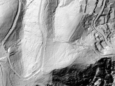
Elevation, orientation, shadows and slope information to be used in your applications, using WMS geoservices

Elevation, orientation, shadows and slope information to be used in your applications, using WMS geoservices
Vegetation information for your applications through WMS geoservice, such as fires, biomass and biophysical variables of the forest
The geoservice WMS NDVI (Normalized Difference Vegetation Index) measures the growth of plants and controls the production of biomass
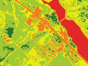
Satellite NDVI visualization WMS service. The service facilitates the use of monthly NDVI generated from January 2024 until the revision date of this metadata
The geoservice WMS contains the representation of different biophysical variables of the forest of Catalonia

Visible and infrared channels of the Ribera d'Ebre fire 2019 on orthophotomap

Information on emblematic peaks and geodetic vertices to be used in your applications through WMS geoservices
Vector mapping for your applications using REST services
GNSS observation files (RINEX), seismic data and other actionable files
Downloading of the RINEX observation files of the GNSS stations of the CatNet network

The use of the different lithologies present in a given territory has represented a very important resource throughout history to improve people's quality of life

The importance of minerals, observation, characterization and the Table of Minerals of Catalonia

Permanent geology exhibition located in the urban center of Tremp

Collection of learning tools that complement the exhibition "Maps, country, future: centenary of the Catalan cartographic exhibition (1919)"

On the occasion of the 150th anniversary of the discovery of the periodic table, the ICGC has produced the Catalan version of the periodic table.

20,000 terminological files related to Earth sciences and related fields that TERMCAT makes publicly available

Rock textures - Learning resource allows you to obtain interactive educational material aimed at ESO and Baccalaureate students

Interactive tool that shows the exhibition of photographs by Jordi Lluís Pi that highlights the geodiversity of our territory

Relevant international projects organized by themes