


Applications and viewers
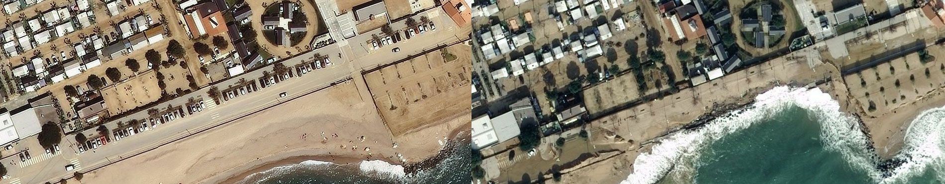
Comparison of orthoimages generated from aerial photographs captured before and after storms


Coastal geomorphology with the classification of typologies and their units, dune surface mapping, and the characterization of littoral sediments

Geomorphological maps of the areas flooded by marine storms that have affected the Catalan coast in recent years

Permanent flooding for five climate scenarios and nine time horizons

Interactive tool that allows you to visualize and analyze coastline data, coastal orthophoto and bathymetry


