


ContextMaps
ContextMaps is the benchmark for cross-sectional topographic cartography
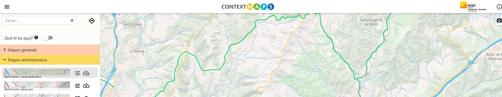
ContextMaps is the portal for accessing the ICGC's topographic and thematic cartography. The maps are generated with VectorTiles technology (vector/image), which allows for fast and agile access. It has specific services and functionalities that allow for flexible generation, customization and publication of cartography. At the same time, it also allows for continuous visualization and analysis of the geographical information and knowledge of Catalonia with that of the rest of the world, thanks to the homogeneous and global processing of data with OpenStreetMap information, following the OpenMapTiles scheme [1]. However, in the case of Catalonia, the scheme is expanded to cover its own needs.
Credits
Catalonia. Cartographic and Geological Institute of Catalonia (ICGC) and data from other organizations: Generalitat de Catalunya (Gencat; protected areas, road network); FGC, RENFE and ADIF (railways); county councils, Conselh Generau d'Aran and the Barcelona Provincial Council's Natural Parks Network (points of interest and hiking and cycling itineraries).
| Cartography subject to a Creative Commons Attribution 4.0 International license More information |
Rest of the world. Vector mapping: © OpenStreetMap contributors. Data subject to the Open Database License (ODdL). Terrain: © Mapzen, OpenStreetMap, and others. Orthoimage: ESRI World Imagery (Source: Esri, Maxar, Earthstar Geographics, and the GIS User Community).
Data schema. OpenMapTiles, OpenStreetMap, ICGC.
Data date. 2022.
The OpenMapTiles schema is the meeting point between the data contained in the Open Street Map cartographic database and those collected by the ICGC. The integration into the same data schema allows data from different origins to be visualized and stylized in unison. They also allow their consumption through a single URL, which makes it easier for developers to use this cartographic database in their browsers and applications.
The same set of cartographic data of the territory that the ICGC periodically collects with high precision has been organized in order to generate an agile and lightweight distribution service in vector tiles format (vector tiles [2]) that allows total customization in the appearance of the final product that is shown to the citizen through the editing of style sheets [3].
This agility and lightness of the data served while preserving all the precision and attributes of the original data makes it ideal for web applications that require a high level of personalization and also makes it optimal for use as reference cartography in mobile environments with and without connection.
The ContextMaps viewer shows the content and structure of the geographic information and the potential of this interactive and friendly technology and, at the same time, explains its specific functionalities, created to facilitate its use, provide quick and personalized solutions and visualizations in the web world and apps.
The ContextMaps cartography of Catalonia is generated from the official cartography of the ICGC and other specialized official sources. Information from outside Catalonia is obtained essentially from the OpenStreetMap collaborative database; the terrain data, from Mapzen; the orthoimage, from ESRI's World Imagery.
The cartography of the area of Catalonia will be systematically updated with different periodicity depending on each layer. New content, layer relationships and styles and tools will be incorporated in new versions.
Among other things, ContextMaps offers the following services:
- View map layers and images.
- View different preset stylizations.
- Edit and save new styles from existing ones.
- Load a style.
- Activate and deactivate some layers.
- View information about map elements by hovering over them (example: municipality, basic health area, census section, cartographic unit of the geological map, etc.).
- Highlight the entire road by hovering over it.
- View the directions of traffic.
- Generate a file with the image being viewed, with configuration options.
- Obtain the URL address of the style and download it with the viewer configuration.
- Use different APIs developed by the ICGC.
- Measure distances, modify the orientation and inclination of the map, have a 2D or 3D view.
- The links generated from the different visualizations can be used as a base map service (Map as a Service or MaaS) on websites and third-party tools, administrations, companies and users in general.
What's new
April 2023:
- Update of the road layers, administrative divisions and toponymy.
- Relief information based on the 5x5m Digital Terrain Model.
- Incorporation of points of interest (POI), sidewalks and basic health areas.
- New standard style, in which more information can be displayed at each zoom level (symbols, toponyms, etc.).
ContextMaps viewer
Service URL
https://geoserveis.icgc.cat/vector-tiles/contextmaps//{z}/{x}/{y}.pbf
References
[1] Esquema OpenMapTiles de tessel·les vector. https://openmaptiles.org/schema/
[2] Especificacions del format Vector Tiles de Mapbox. https://docs.mapbox.com/vector-tiles/reference/
[3] Especificacions dels fulls d'estil per a la visualització de tessel·les vector de Mapbox. https://docs.mapbox.com/mapbox-gl-js/style-spec/