


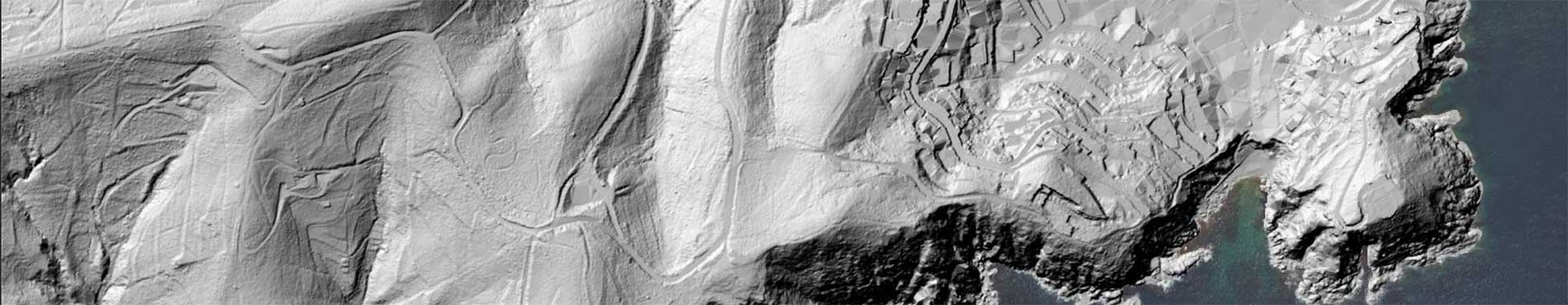
WMS Coastal elevations
WMS service for visualizing coastal elevation models.
Connection URL
https://geoserveis.icgc.cat/servei/catalunya/elevacions-litoral/wms
- Publication date: March 2026.
- Information date: 2014, 2015, 2016, 2017, 2022, 2023 and 2024.
Technical characteristics of the service
- Supported OGC: 1.3.0, 1.1.1.
- Original EPSG: 25831.
- Supported EPSGs: 4326, 4258.
- GetMap formats supported: PNG, JPEG, TIFF.
- Supported OGC methods: GetCapabilities, GetMap, GetFeatureInfo.
Available layers
| Layer | Layer name | Range of scales |
|---|---|---|
| Coastal terrain elevation model (layer group) | model-elevacions-terreny-litoral | |
| Coastal terrain elevation model - <temporal range> | model-elevacions-terreny-litoral-lidar-<resolució>-aaaamm-aaaamm | All the scales |
| Shaded coastal terrain elevation model (layer group) | model-elevacions-terreny-litoral-ombrejat | |
| Shaded coastal terrain elevation model - <temporal range> | model-elevacions-terreny-litoral-ombrejat-lidar-<resolució>-aaaamm-aaaamm | All the scales |
| Coastal buildings terrain elevation model (layer group) | model-elevacions-terreny-edificis-litoral | |
| Coastal buildings terrain elevation model - <temporal range> | model-elevacions-terreny-edificis-litoral-lidar-<resolució>-aaaamm-aaaamm | All the scales |
| Shaded coastal buildings terrain elevation model (layer group) | model-elevacions-terreny-edificis-litoral-ombrejat | |
| Shaded coastal buildings terrain elevation model - <temporal range> | model-elevacions-terreny-edificis-litoral-ombrejat-lidar-<resolució>-aaaamm-aaaamm | All the scales |
| Coastal surface model (layer group) | model-superficies-litoral | |
| Coastal surface model - <temporal range> | model-superficies-litoral-lidar-<resolució>-aaaamm-aaaamm | All the scales |
| Shaded coastal surface model - <temporal range> | model-superficies-litoral-ombrejat | |
| Model de superfícies del litoral ombrejat - <rang temporal> | model-superficies-litoral-ombrejat-lidar-<resolució>-aaaamm-aaaamm | All the scales |
| Coastal orientation model (layer group) | model-orientacions-litoral | |
| Coastal orientation model - <temporal range> | model-orientacions-litoral-lidar-<resolució>-aaaamm-aaaamm | All the scales |
| Model of colorful coastline orientations (layer group) | model-orientacions-litoral-rgb | |
| Colored coastline orientations model - <temporal range> | model-orientacions-litoral-rgb-lidar-<resolució>-aaaamm-aaaamm | All the scales |
Example service request
