


Territorial Orthophoto
Continuous mosaic of aerial photographs, of high quality and precision

The reference image base with total coverage of the territory constitutes the Territorial Orthophoto, both in its RGB color and IRC false color versions.
The product and services associated with the Territorial Orthophoto provide complete territorial and temporal coverage, allowing viewing and downloading in a single file (full coverage) both the current and last published orthoimage as well as all territorial coverage orthoimages carried out by the ICGC according to the different years of flight. Likewise, el servei WMS Territorial Orthophoto service allows the orthoimage in production to be visualized and integrated into applications that support the WMS protocol as the different stages of product development progress (formerly ortoXpres).
Main characteristics
- Optimal working scale: 1:2,500 for recent coverage.
- Date of information: Annual from 2025 to 1983 (except 1999 and 1991 which are not available), 1977, 1975, 1970, 1956 and 1945.
- Description: Territorial orthophoto of all Catalonia organized by year.
- Download formats:
- GeoPackage.
- ECW.
| This cartography is under the Creative Commons Attribution 4.0 International license. More information |

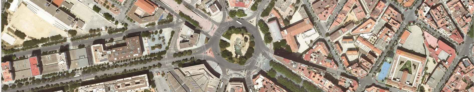
Imperial Tarraco Square.
The Territorial Orthoimage of Catalonia is the reference product of higher resolution territorial coverage offered by the ICGC and produced and distributed annually.
Currently, the product is generated from flights of 22 cm (2/3 of the territory) and 28 cm (1/3 of the territory) over the territory of Catalonia to generate a continuous orthophoto of the territory of 25 cm pixels both in color (RGB) and in infrared (IRC) with an annual frequency.
The product is distributed by area (in JPG, JP2, PDF, TIF and ECW format) and by years in single sheet (full coverage) in Geopackage and ECW format, where each file encompasses the image production of a single year and resolution. The files include in their nomenclature the information corresponding to:
- Color type. RGB for color images, IRC for infrared images and BN for panchromatic images.
- Resolution. Corresponding to the pixel size expressed in cm: 250 cm, 50 cm, 25 cm, 15 cm and 10 cm.
- Area. Name of the territory covered by the image. The most common is Catalonia, which is used for general territorial coverage, although in old flights they may not be complete; Girona, Barcelona and Costa also appear, indicating that these are flights made with more localized coverage.
- Year. Indicating the year of the flight to which the information corresponds.
Example: orthophoto-rgb-25cm-catalunya-2010 is the orthoimage of Catalonia with a pixel size of 25 cm in RGB color corresponding to 2010.
Coverage groups
The annual orthoimages make it possible to have complete coverage of the territory through the grouping of years. In the WMS Territorial Orthophoto, in addition to the annual orthoimages, the layers with the groupings by coverage can be loaded directly. Likewise, the WMS in question offers multi-resolution groupings, allowing the production of the same year to be combined in the same service with the highest level of detail (resolution) available.
The following shows all the coverage offered within the Territorial Orthophoto, taking into account these groupings:
1945-1946 
| 1945 
| 1946 
| It is the flight known as American Flight Series A. Performed during 1945 and 1946 by the United States Air Force. The orthoimage presents a strip without coverage that is covered with the subsequent coverage, but allowing the identification of the added strip. |
1956-1957 
| 1956 
| 1957 
| It is the flight known as American Flight Series B. Performed during the years 1956 and 1957 by the United States Air Force. |
1970-1977 (parcial) , 25 cm b/n i 15 cm b/n")
| 1970, 25 cm b/w 
| 1975, 15 cm b/w 
| 1977, 25 cm b/w 
|
1983-1989 
| 1983 
| 1986 
| 1987 
| 1988 
| 1989 
|
1990 (partial) 
|
1993 
|
1994-1997 
| 1994 
| 1995 
| 1996 
| 1997 
| Entry into operation of the RC-30 analog camera replacing the RC-10. |
2000-2003 
| 2000 
| 2001 
| 2002 
| 2003 
| First color orthoimage coverage. First orthoimage coverage with geometric continuity between the different sheets. |
2004-2005 
| 2004 
| 2005 
| First orthoimage coverage with radiometric continuity between the different sheets. |
2006-2007 
| 2006 
| 2007 
| The ICGC's first digital camera, the DMC-I, enters into operation, with which production is carried out in 2007. The ICGC will have two DMC-I units until 2017. |
2008 
| First coverage in a single year with a pixel size of 50 cm. |
2009 ")
| First annual coverage with a pixel size of 25 cm. First simultaneous production of color (rgb) and infrared false color (irc) orthoimage. |
2010 (partial) , 25 cm rgb (+irc) i 10cm rgb")
| 2010, 25 cm rgb 
| 2010, 10 cm rgb 
|
2011 (partial) , 25 cm rgb (+irc) i 10cm rgb")
| 2011, 25 cm rgb 
| 2011, 10 cm rgb 
|
Since 2012 ")
| In 2017, the new ICGC digital camera goes into production: the DMC-III. The 2020 coverage is complemented by the Barcelona metropolitan area at 10 cm RGB. |
Did you know that...?There are several historical flights of general coverage over the Spanish State.
|