


Territorial Topographic Reference
Reference topographic base with total coverage of the territory

The reference topographic base with total coverage of the territory of Catalonia constitutes the Territorial Topographic Reference (RTT).
Service features
- Version: v1.
- Optimal work scale: 1:5.000.
- Date of the data source: 2024.
- Description: Territorial topography of all Catalonia organized by layers.
- Download format:
- 2D GeoPackage with built-in default styles and project for QGIS.
- Geodatabase with built-in default styles for ArcGIS Pro.
- GeoTIFF.
- DWG (for municipalities), in 2D and 3D, also with object data.
- DGN (for municipalities), in 2D and 3D.
- 3D Geopackage.
- IFC for BIM.
For the correct visualization of the data with the predefined style and other considerations, we suggest consulting the manuals included (annexes) in the technical specifications of this information (Catalan) (29.06.2026).
| Cartography from the Cartographic and Geological Institute of Catalonia subject to a Creative Commons Attribution 4.0 International license (CC BY 4.0). More information. |
Layers available
Relief
It includes elements that allow characterizing the relief: point heights, contour lines, slopes, embankments, cuttings, among others.
Hydrography
It includes different hydrographic elements, both natural (rivers, dry riverbeds, coastline, ...) and artificial (reservoirs, irrigation channels, swimming pools, ...).
Transportation
It includes the elements of the different networks that make up the transport network: road, rail, port, airport and cable. The road network has the necessary attributes for its categorization.
Buildings
It includes different types of artificial constructions (buildings, walls, electrical towers, warehouses, urban islands, ...), as long as these are not included in the thematic layer of transport.
Land covers
Includes natural (rock, beach, forest, ...) and artificial (open mines, landfills, ...) land covers.
Geographical names
Include the texts with the place names. The elements are classified geographically based on a coding that identifies the designated geographic elements, and typologically in the recommended fonts and fonts for their representation in order to facilitate the reading and interpretation of the cartography. The geometry corresponds to the line on which the text is placed.

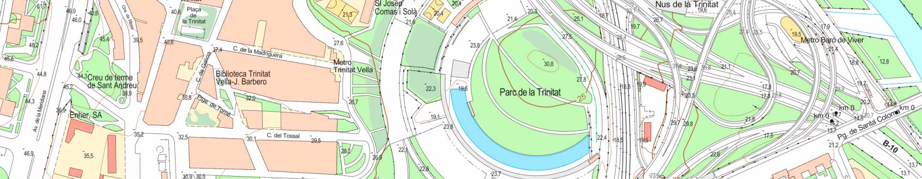
RTT, Plaça de la Imperial Tarraco
This organization of the information facilitates an agile and versatile use of the data, since it allows working with all the information at the same time, or making selections by layers of information or by territorial areas, as well as changes in the symbolization. This distribution is prepared to work at scales close to 1: 5,000.
To ensure the most widespread use possible, specific formats are distributed both for users who work with GIS and for users who work with CAD.
The most relevant GIS formats are the Geopackage, which can be exploited from free software, as well as the geodatabase, for users of the ESRI platform. In both cases, the file contains vector data organized in the different thematic layers, as well as metadata tables and descriptions of the attribute values. The files incorporate a stylization, for the free software QGis in the case of the Geopackage, and for ArcGIS Pro in the case of the geodatabase.
For users who work with CAD software, DGN (for MicroStation) and DWG (for AutoCAD) formats are distributed, both in 2D and with 3D information. In all cases, the information is grouped by levels with descriptive names and with a symbolization adapted to the destination software, as well as the attributes of the different objects incorporated into the file. In the case of the DGN format, the attributes are incorporated as itemtypes, and in the case of the DWG format they are distributed in two versions: one with attributes as tags, consultable from AutoCAD, and another with attributes as object data, consultable from AutoCAD Map.
Additionally, the IFC (Industry Foundation Classes) format allows the incorporation of information from the Territorial Topographic Reference in BIM (Building Information Modeling) work environments. This format facilitates the integration of topographic data in architecture, engineering and construction projects, favoring interoperability between different platforms and improving project coordination.