


Image

Satellite NDVI mosaic to monitor the vegetation of Catalonia with monthly update and 10-meter resolution

Complete set of images, aerial and satellite, for the creation of the Catalonia land cover map using Artificial Intelligence (AI) techniques
")
Datasets for thematic classification and change detection

The Fototeca de Catalunya Viewer facilitates access to the catalog of vertical aerial photographs from 1942 to the present day

Program for capturing aerial photographs using photogrammetric cameras

Orthophoto of the coastal strip with a resolution generally between 10 and 15 cm on the ground

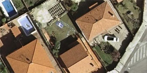
Mosaic of high-resolution aerial photographs of urban areas, both in color (RGB) and in color infrared (IRC)


Continuous mosaic of monthly images captured by the Sentinel-2 satellite

Mosaic of color images (RGB) captured by the Sentinel-2 satellites (summer and winter) and without clouds or other "artifacts"

