Busqueda SearchApi | icgc
596 results found

Filters:

Imatge
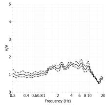
H/V Spectral ratio of seismic noise records from Tremp seismic station

H/V Spectral ratio of seismic noise records from Tremp seismic station.

Imatge
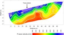
P-waves velocity model of Tremp seismic station

P-waves velocity model of Tremp seismic station.

Imatge
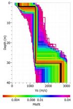
S-waves velocity model of Tremp seismic station

S-waves velocity model of Tremp seismic station.

Imatge
Epicenters of recorded events (courtesy S. Godey, 2010)

Epicenters of recorded events (courtesy S. Godey, 2010)

Imatge
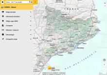
Screenshot of VISSIR 4 of the Cartographic and Geological Institute of Catalonia (ICGC). On the left is a side menu with the options "Base map", "Thematic information", "Add WMS layer", "Compare", "Draw and measure", "Download" and "Share map". On the right is the map of Catalonia with relief, roads and main towns, as well as the zoom and navigation controls of the viewer.

Main interface of VISSIR 4 of the ICGC, with the side menu of tools open and the map of Catalonia in the viewer.

Imatge
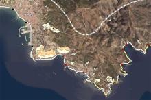
Screenshot of the Coastal hazard viewer focused on the coast of Cap de Creus, between Roses and Cadaqués. Several thematic layers with polygons of different colors are shown on an orthophotograph representing coastal danger zones, as well as a prominent coastline and several control points distributed along the coast. The urban center of Roses and the road network in the area are also identified.

Coastal hazard viewer, with the representation of the danger zones on the coast of Cap de Creus.

Imatge
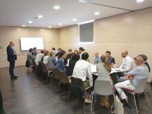
Several people sitting around a table participating in a working session. A presentation is projected on the screen in the background, while on the table there is a work panel, markers and notes used during the dynamic.

Participants during the Space Economy Congress 2026 workshop.