



Geological structure measurements
Geological structure measurements is a geological information dataset that records, as point features, the planar or linear orientation and the dip or inclination of geological structural elements that define their 3D spatial geometry.
This 2D vector geoinformation is distributed in Geopackage and Geodatabase formats.
The coordinate reference system used is the official one in Catalonia (ETRS89 UTM Zone 31N).
Publication date: March 2026.
Date of information: 1972–2022.
Version: v1.0.

| Geoinformation from the Cartographic and Geological Institute of Catalonia is subject to a Creative Commons Attribution 4.0 International (CC BY 4.0) licence. More information. |
Description
The purpose of distributing this dataset is to provide geological structure measurement data for the development of any geology-related activity at a territorial scale. In addition, it enables analytical operations and queries in combination with other geothematic information datasets.
Structural measurements are divided into two groups:
- Planar geological structure measurements: measurements that characterise the 3D spatial orientation of two-dimensional geological structural elements defined by a plane.
- Linear geological structure measurements: measurements that characterise the 3D spatial orientation of one-dimensional geological structural elements defined by a line.
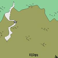
Observed measurements
The data contain attributes included in the GeoSciML data model, which is a standard language for the transfer and exchange of geological data (including data from geological maps, borehole data and geological information from various sources).
This dataset is considered essential for visualising and analysing other geological information datasets defined in the Cartographic Plan of Catalonia 2022 (Geological Map 1:250,000, Geological Map 1:50,000, Geological Map 1:25,000).
Structural element measurements have been acquired using geological compasses (analogue compasses, digital compasses or mobile phone applications) during the production of the Geological Map of Catalonia at 1:25,000 scale by the ICGC and the Geological Map at 1:50,000 scale of the IGME MAGNA geological series.
The implementation of the dataset has followed different methodologies depending on the source of information:
- For published paper maps where the original structural measurements were not available, the measurements were acquired using digital geometric capture techniques.
- For maps for which the original measurement data were available in digital format, the measurements were transferred directly from the digital files.
Featured use cases
Measurements of geological structural elements are important because they make it possible to deduce the geometry of geology at depth, a key factor for subsurface applications.
Mesoscale folds
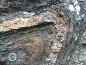
Folded planar structures (clivatge)
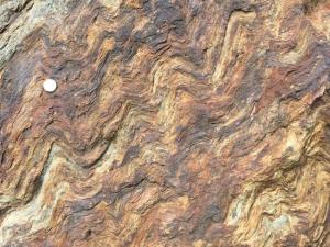
Linear structures (fold axes)