


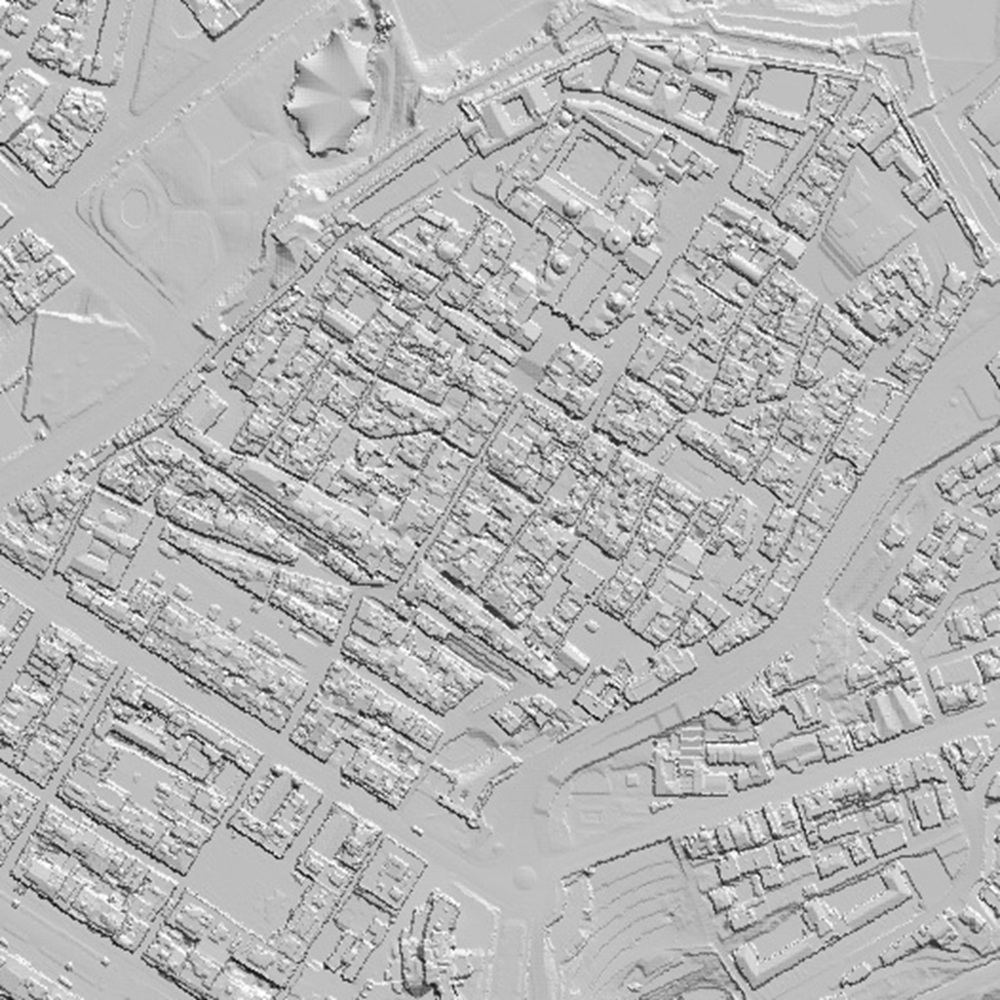
Specific Territorial Elevation Models
High-Resolution Elevation Models with Buildings of Catalonia, and also with Vegetation
ICGC provides the Digital Terrain Model with Buildings (DTMb), which covers the territory of Catalonia at a resolution of 1 m. It is generated from territorial LiDAR survey flights, using georeferenced, classified and validated point clouds, and combines terrain and building classes to integrate topography and built structures. Likewise, by also using LiDAR points classified as vegetation, ICGC provides the Digital Terrain Model with Buildings and Vegetation (DTMbv) with a 1 m resolution and coverage of the whole of Catalonia.

| Geoinformation from the Cartographic and Geological Institute of Catalonia is licensed under the Creative Commons Attribution 4.0 International (CC BY 4.0). More information |
Latest update
- Publication date: September 2026.
- Reference date: 2021–2023.
- Version: v1.0.
Description
ICGC provides two high-resolution elevation models that integrate topography with the main features present across the territory: the MDTe and the MDTev. Both products cover the whole of Catalonia with a spatial resolution of 1 metre and constitute highly valuable tools for applications related to territorial planning, impact simulation, environmental analysis and three-dimensional modelling.
These models are generated from the territorial LiDAR survey flights carried out by ICGC. LiDAR technology enables the acquisition of georeferenced three-dimensional point clouds, which undergo classification and validation processes to identify the different features present across the territory, such as terrain, buildings and vegetation. Based on this information, the classes of interest are selected to generate different representations of the surface.
The MDTe combines the natural terrain surface with existing buildings. It is generated exclusively from LiDAR points classified as terrain and buildings, producing a continuous representation that integrates topography and building volumes. This model is particularly suitable for urban integration studies, viewshed simulations, drainage analysis in urbanised environments, infrastructure planning, engineering projects that require consideration of the effects of buildings on the territory, shadow analysis and solar potential studies.
The MDTev extends this information by also incorporating points classified as vegetation. The result is a more complete representation of the visible surface of the territory, integrating topography, buildings and vegetation cover. This product is particularly useful for environmental and forestry studies, landscape analysis, telecommunications signal propagation simulations, wildfire risk modelling, shadow analysis and any application requiring consideration of the presence and distribution of vegetation and buildings.
MDTe and MDTev benefit from the same acquisition and update process as the products derived from territorial LiDAR survey flights, with an approximate update cycle of four years. This frequency provides an accurate and homogeneous representation of changes across the territory, both in urban areas and in vegetation cover.
Taken together, the MDTe and MDTev models complement traditional elevation models by offering a representation that is closer to the physical reality of the territory. This makes them a highly valuable source of information for professionals in engineering, urban planning, environmental management, civil protection and research, facilitating spatial analysis and decision-making based on high-quality geospatial data.
Main Technical Characteristics
- Data source: LiDAR point cloud acquired through Catalonia-wide territorial survey flights.
- Resolution: 1 m pixel.
- Reference system: EPSG:25831.
- Format: GeoTIFF (raster). NoData value: -9999.
Use Cases
- Urban and territorial planning, to assess the implementation of new developments, infrastructure or facilities while considering their relationship with the built environment.
- Visibility and visual impact analysis, enabling the identification of areas visible from a given location and the assessment of the landscape impact of new buildings, energy infrastructure or landmark features.
Telecommunications coverage simulations, since buildings, vegetation and terrain relief can act as obstacles and affect the propagation of radio, mobile phone and wireless network signals.
Imatge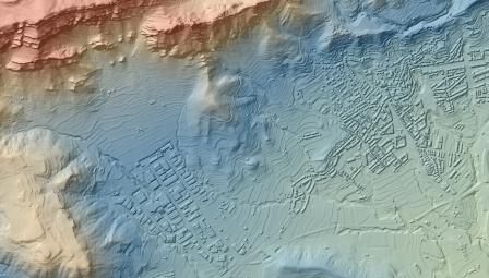
DTMe of Berga
Imatge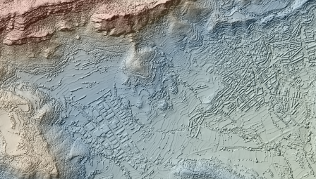
DTMev of Berga
- Hydrological modelling in urban environments, where the presence of buildings influences surface water flows and may affect flood risk assessments.
- Engineering and civil works projects, facilitating preliminary route studies and the integration of infrastructure within urban and peri-urban areas.
Shadow analysis, to determine the shadows cast by buildings on their surroundings at different times of the day and year, taking into account building heights, the position of the Sun and terrain topography. It is useful for assessing sunlight exposure in public spaces, streets, courtyards and green areas, as well as studying the effects of new developments on nearby buildings and spaces.
Imatge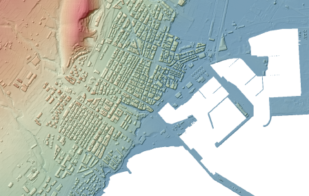
DTMe de La Ràpita
Imatge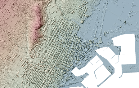
DTMev of La Ràpita
- Solar potential studies, to identify rooftops and land surfaces with the greatest potential for installing solar energy systems, taking into account surface orientation and slope, shading caused by buildings and terrain, and incident solar radiation.