


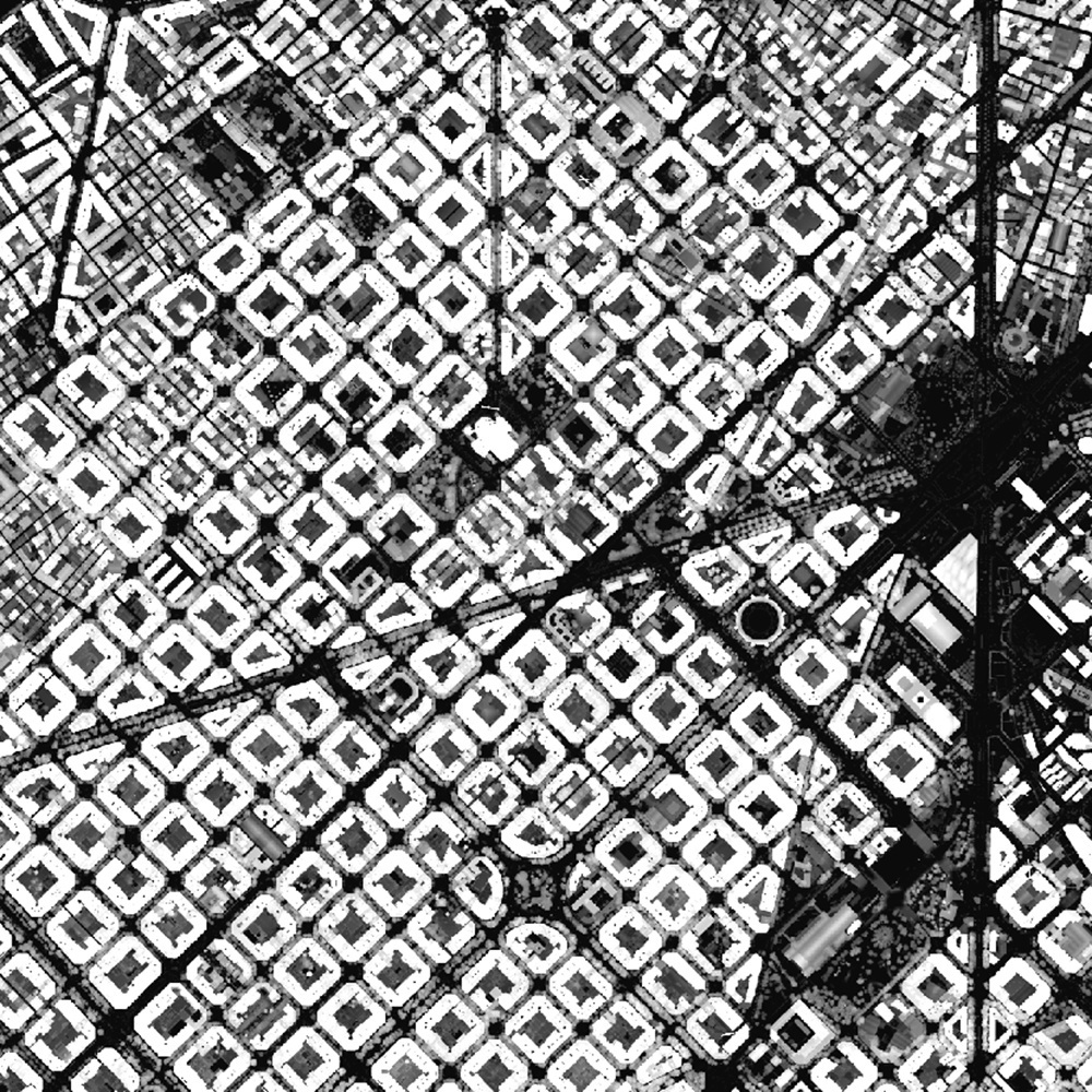
Height Models
High-Resolution Height Models of Catalonia
ICGC provides the Height Model (also referred to as the normalized Digital Surface Model -nDSM-) covering the whole of Catalonia at a resolution of 1 m. It is generated from territorial LiDAR survey flights using georeferenced, classified and validated point clouds, calculating the height of each point above the terrain and obtaining, for each pixel, the maximum height of the points it contains. Likewise, but considering only the height of points classified as vegetation, ICGC provides the Vegetation Height Model (also known as the Canopy Height Model -CHM-) with a resolution of 1 m and coverage of the whole of Catalonia.

| Geoinformation from the Cartographic and Geological Institute of Catalonia is licensed under the Creative Commons Attribution 4.0 International (CC BY 4.0) licence. More information |
Latest update
- Publication date: September 2026.
- Date of the information: 2021–2023.
- Version: v1.0.
Description
ICGC provides two elevation products derived from territorial LiDAR survey flights that make it possible to determine the height of features above the ground: the nDSM and the CHM. With a spatial resolution of 1 metre and coverage of the whole of Catalonia, these products provide detailed information on the relative height of buildings, vegetation and other objects with respect to the terrain.
These models are generated from georeferenced, classified and validated LiDAR point clouds. For each point, its height above the ground is calculated as the difference between its elevation and the elevation of the Digital Terrain Model (DTM). The result is a representation that does not show absolute elevation, but rather the actual height of objects above the ground surface.
The nDSM represents the maximum height of the objects present within each pixel, regardless of their nature. To generate it, all points located above the ground are considered, including buildings, vegetation, infrastructure and other artificial or natural features. The result is a continuous model that describes the height of objects across the territory and enables their volume and spatial distribution to be characterised.
The CHM, on the other hand, is generated exclusively from LiDAR points classified as vegetation. This model represents the height of vegetation cover above the ground, providing a detailed description of the vertical structure of forests, tree stands and other vegetation formations. By removing the influence of buildings and other artificial features, the CHM becomes a dedicated tool for forestry and environmental analysis.
The nDSM is particularly useful for urban and territorial analysis applications. It enables the identification and characterisation of buildings, the estimation of building heights, the generation of three-dimensional city models, and visual impact analysis. It is also a valuable source of information for landscape exposure analysis and the development of digital twins of the territory.
The CHM is primarily intended for forestry and environmental applications. Its main uses include the characterisation of forest stands, estimation of tree heights, identification of vegetation growth patterns and monitoring of forest dynamics. It is also a highly valuable product for supporting forest inventories, wildfire risk modelling, natural habitat assessment, biodiversity studies, and the quantification of biomass and carbon stored in vegetation.
Regarding updates, both the nDSM and the CHM are generated from ICGC territorial LiDAR survey flights, which follow an approximate four-year renewal cycle. This frequency provides homogeneous and up-to-date information on the evolution of urban areas, forest cover and territorial changes.
Taken together, the nDSM and CHM complement traditional elevation models by adding an additional dimension: the height of objects above the terrain. This information is essential for professionals in urban planning, territorial planning, forest management, nature conservation and research, enabling advanced analyses and a better understanding of the three-dimensional structure of the Catalan territory.
Main Technical Characteristics
- Data source: LiDAR point cloud acquired through Catalonia-wide territorial survey flights.
- Resolution: 1 m pixel.
- Reference system: EPSG:25831.
- Format: GeoTIFF (raster). NoData value: -9999.
Use Cases
Main Applications of the Height Model (nDSM)
Monitoring Territorial Changes
Comparing different editions of the model makes it possible to detect and quantify changes occurring across the territory, such as new buildings, demolitions, infrastructure modifications, vegetation growth or earthworks. This temporal monitoring capability makes it a particularly useful tool for territorial management, cartographic updating and landscape change monitoring.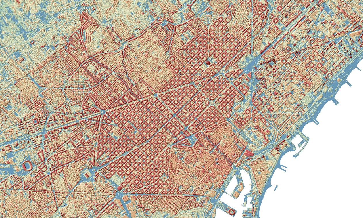
nDSM of the Eixample
Territorial and Urban Planning and 3D Analysis
It enables the identification of buildings and other above-ground features, estimation of their heights and characterisation of their volumetry. It is a useful tool for urban and territorial planning, infrastructure design, the generation of three-dimensional models and digital twins, as well as the calculation of volumes for buildings, structures and earthworks.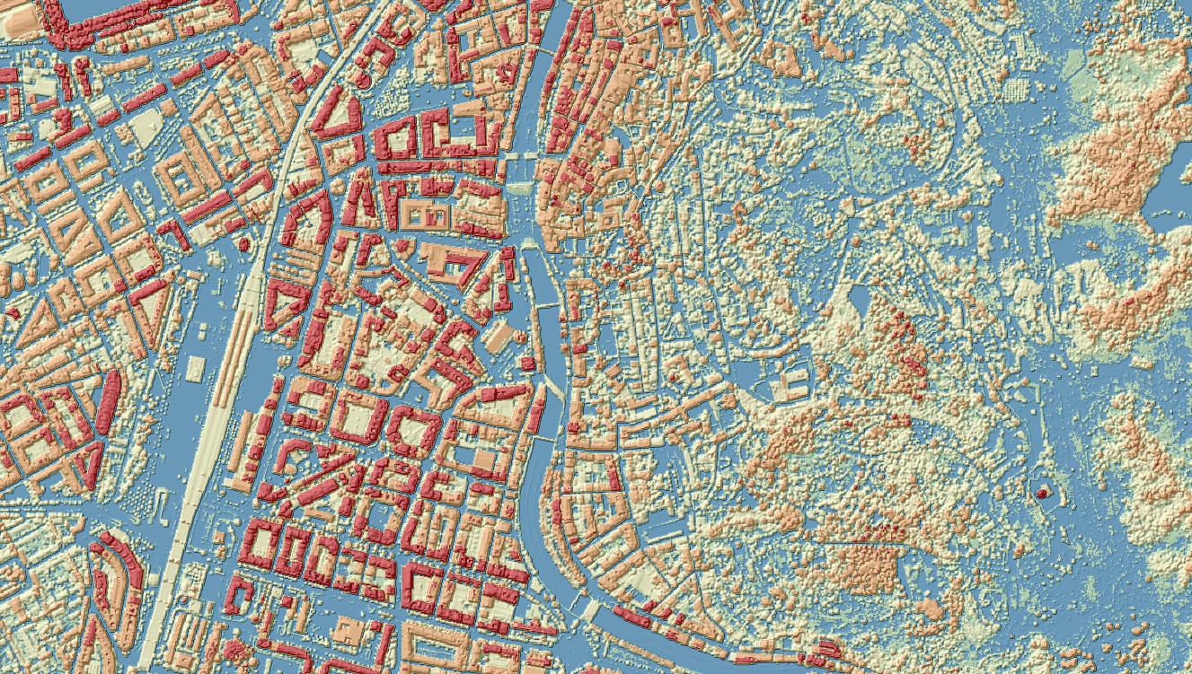
nDSM of Girona
- Environmental Analysis and Decision Support
It facilitates visibility studies and landscape impact assessments. It also provides valuable information for the assessment of natural or technological risks, emergency planning and other studies requiring a realistic representation of features present across the territory.
Main Applications of the Canopy Height Model (CHM)
The Canopy Height Model (CHM) represents only the height of vegetation above the ground and is one of the most widely used products in the forestry, environmental and nature conservation fields. Its main applications include:
Forest Management and Planning
It enables the estimation of forest stand heights and the identification of different stages of forest development. It is a supporting tool for forest inventories, silvicultural planning, prioritisation of interventions and the sustainable management of forest resources.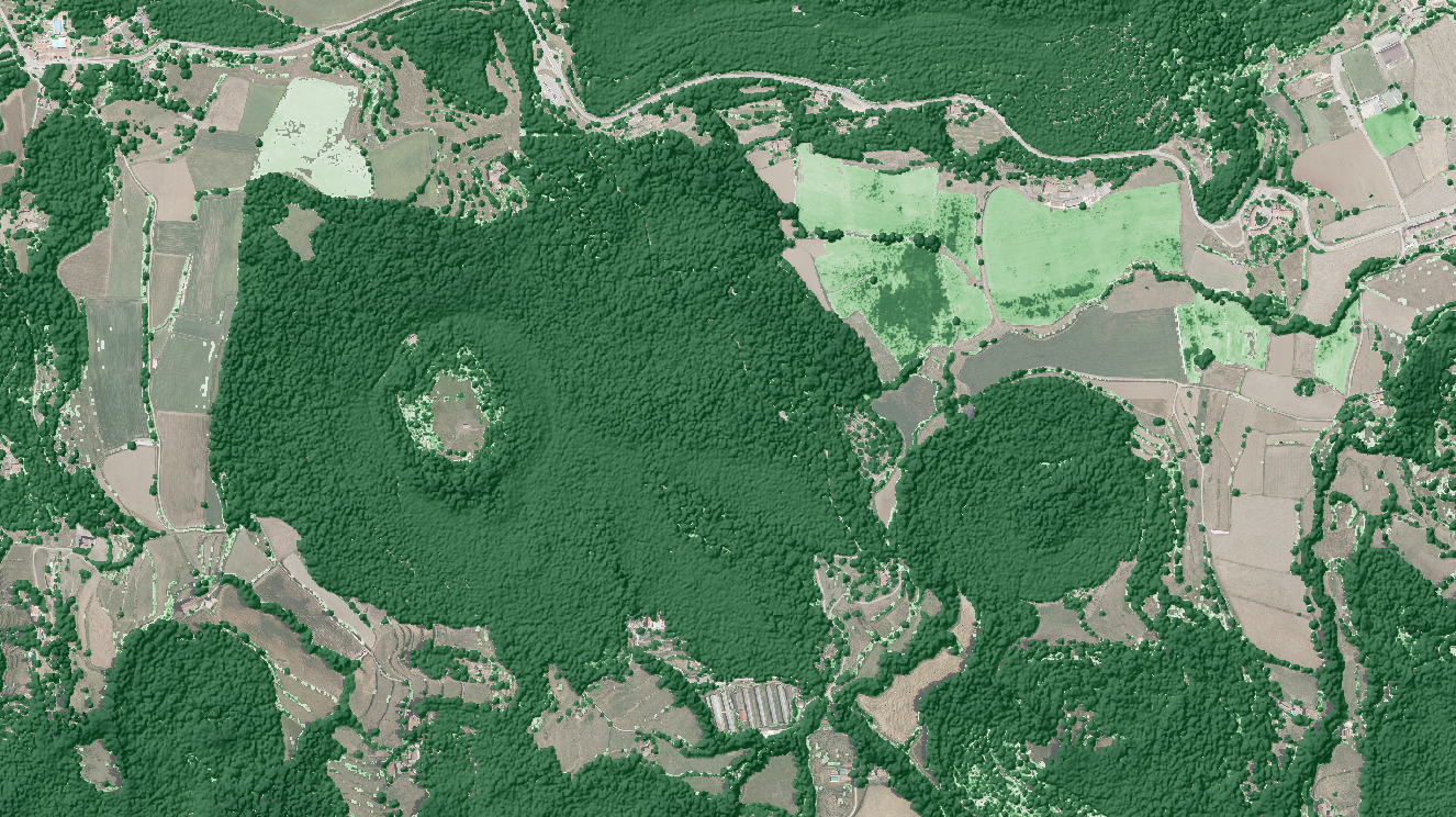 CHM of the Santa Margarida Volcano (Olot)
Environmental and Ecological Analysis and Nature Conservation
It serves as a valuable information source for the development of forest biomass and carbon stock estimation models, as well as for habitat and ecosystem characterisation. It also contributes to biodiversity studies, ecological connectivity analyses, and the planning and monitoring of protected natural areas.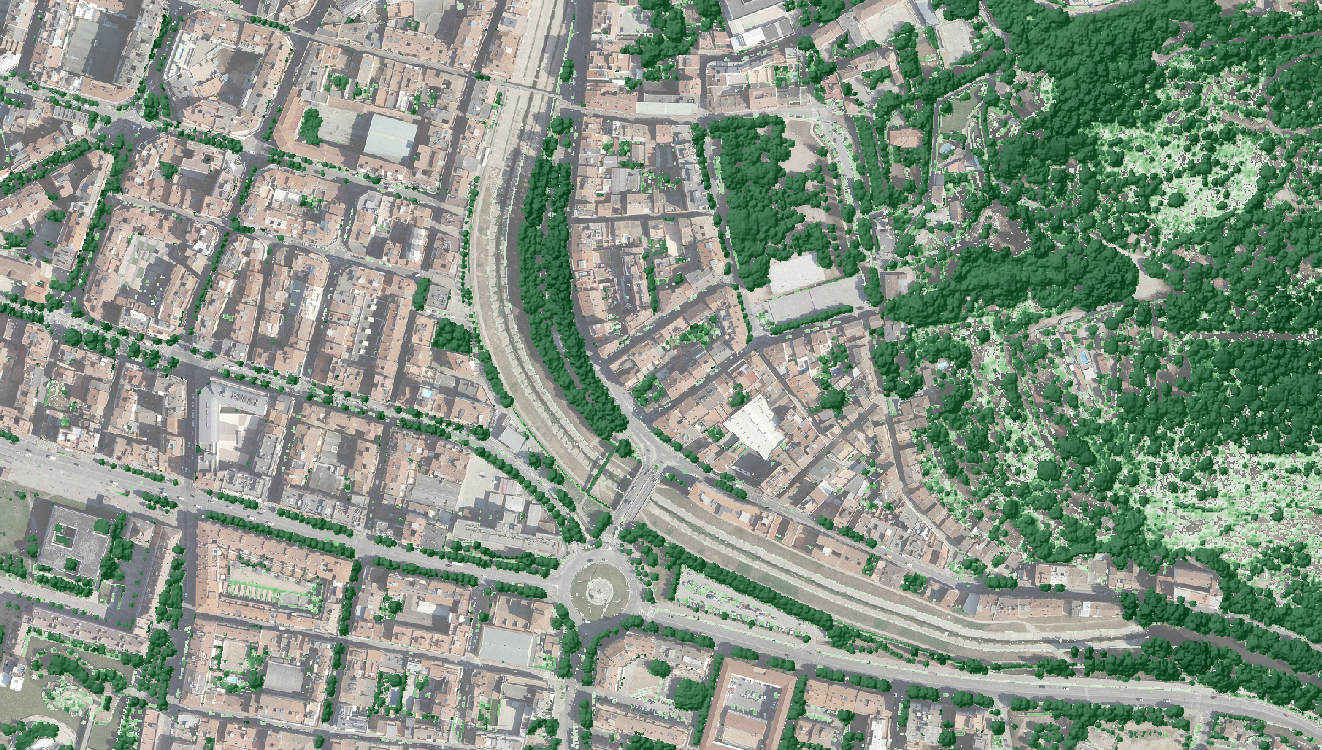
CHM of Girona
- Risk Assessment and Vegetation Cover Monitoring
It provides essential information for wildfire risk modelling. Comparing different editions of the model also makes it possible to detect and quantify changes in vegetation cover caused by wildfires, droughts, storms, pests or forestry operations, supporting the monitoring of ecosystem condition and evolution.
Complementary Value of Both Models
nDSM: primarily answers the question “How tall are the objects present above the terrain?”, regardless of whether they are buildings, trees or infrastructure.
CHM: specifically answers the question “How tall is the vegetation?”, removing any influence from buildings or other artificial features.
This complementarity makes the nDSM particularly suitable for urban and territorial applications, while the CHM has become a reference tool for forestry, environmental and ecological fields.