Decentralized municipal entities
Geographic base of decentralized municipal entities derived from the delimitation files of the entities and the municipalities to which they belong, and from reference cartographic sources
Geographic base of the Decentralized Municipal Entities (EMD) of Catalonia, with their names and codes, derived from the delimitation files of the entities and the municipalities to which they belong, and from reference cartographic sources.
Of the boundaries of the polygons of the EMD represented in this base, only those that have a recognition act, a resolution published in the DOGC or a judicial resolution that determines the current official line are definitive, as long as they have coordinates in the current reference system. The rest of the boundaries must be considered provisional.
The EMD are a type of entity with a territorial scope lower than the municipality, that is, local governments below the municipalities.
Main characteristics
- The EMD layer is distributed in Geopackage, Shapefile and DWG format, and can also be used through the associated WMS and WFS.
- The coordinate system adopted is the official one in Catalonia (ETRS89 UTM 31 North).
| Geoinformation from the General Directorate of Local Administration and the Cartographic and Geological Institute of Catalonia subject to a Creative Commons Attribution 4.0 International license (CC BY 4.0). More information |
Description
Decentralized municipal entities (EMD) are public bodies that depend on city councils but have autonomy to manage certain services and functions in a part of the municipality. Their main objective is to bring public management closer to citizens, improving administrative efficiency and responding to local needs.
The determination of the polygons of decentralized municipal entities comes from the selective fusion of the following sources of information:
- For the limits of the EMD and the limits between municipalities, of a definitive nature with coordinates in the current reference system, it comes from the reports of the topographic works carried out by the ICGC, based on the acts of recognition, the resolutions published in the DOGC or the judicial resolutions that determine the current official line.
- For the limits of the EMD of a definitive nature without coordinates in the current reference system, it comes from the interpretation of the acts of recognition, the resolutions published in the DOGC or the judicial resolutions that determine the current official line.
- For the boundaries of the EMDs of a non-definitive nature, it comes from the interpretation and approximation of the old Municipal Base of Catalonia 1:50,000 of the ICGC, from the old cartographic minutes and the documentation (acts, notebooks and cartography at a scale of 1:25,000) of the municipal delimitation files deposited at the National Geographic Institute.
- For the boundaries between municipalities of a non-definitive nature, it comes from the topographical re-examinations or technical analyses of the municipal boundary lines of Catalonia carried out by the ICGC based on the documentation (acts, notebooks and cartography at a scale of 1:25,000) of the municipal delimitation files deposited at the National Geographic Institute.
- The boundary line of the polygons, with the sea and neighboring countries, comes, respectively, from the coastline of the 1:5,000 topographic base of the ICGC and from the "Database of Jurisdictional Boundaries of Spain" of the National Geographic Institute.
The final result is a layer of polygons that delimit the decentralized municipal entities existing in Catalonia, with their names and codes.
Case studies
This layer serves as a reference in all those areas of information that decentralized municipal entities require as a basis for work and representation, such as technical activities, analysis, management, planning or administration of the territory and its representation on a map.
One of the cases in which an EMD can be created occurs when a certain nucleus within a municipality has its own identity and its inhabitants demand a management closer and adapted to their specific needs. Some examples would be Bellaterra, constituted as an EMD within the municipality of Cerdanyola del Vallès according to Decree 167/2009 and from which it becomes responsible for the maintenance of public spaces, urban inspections and activities, traffic management, the promotion of culture and sport, and the conservation of heritage; o Campredó, constituted as an EMD within the municipality of Tortosa according to Decree 120/2010 and from which it acquired powers over basic services, cultural activities and maintenance of local infrastructures.

EMD in the Alt Pirineu and Aran area
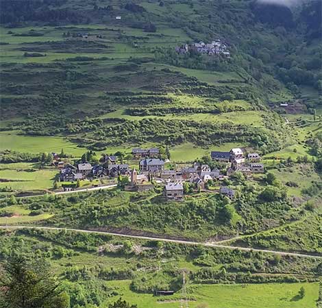
The abundance of EMDs in the Alt Pirineu and Aran areas also stands out, motivated by the orography and the dispersion of population centers beyond their own history and identity. In all these cases, as in the previous ones, the main objective of establishing an EMD is better management of local services (cleaning, road maintenance, cultural activities and small works), in addition to bringing the administration closer to the citizens and preserving their autonomy within the municipalities.
.