


3DHIP-Calculator workflow with an intuitive graphical interface
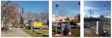
Implementation works of the monitoring network in an urban environment. On the left, drilling of a borehole for the installation of a station.
In the center, instrumentation implementation works. On the right, station prepared for the collection and transmission of data.

Situation maps of the 22 points of measurement and control of the XEGCat of Girona, Salt and Vilablareix

Downloading of data in a point in the secondary sub-network is being performed. Fully-equipped station in the city of Girona. Construction scheme of the open piezometers in the geothermal stations of the primary network. Insights to the inside of a monitoring station showing the instruments used for the collection of data and its ending to the main network.
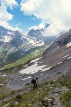
Archive image of a hiker

Example of an approach to the different areas of action of the SOLPYR project, which will work in defined pilot areas and will use the trails as an axis of action.

Block fallen in the 2023 Barruera landslide.