510 results found
Imatge
Structural
Imatge

Land uses
Imatge

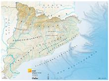
Shaded relief
Imatge

INNOTEC EOSMS system architecture
Imatge

Since 2021, the ICGC has identified and delimited forest covers based on the segmentation of the tree mass in plant and height with data from the new LiDAR TM2 system, TERRAIN Mapper 2.
Imatge

Delimitation and identification of forest covers in urbanized areas.
Imatge