


Left photo, detail of the Rebaixader ravine, between the villages of Senet and Aneto; right photo, detail of the Tossal de la Mola ravine, in Pont de Suert.

Field data observation. Left) Distribution of measurement points on a 1:250000 orthophoto (ICGC, 2019) of the study area. The limit of the study area is marked in blue and the location of the Absolute Gravimetric Base used in this campaign is marked with a red circle. As can be seen in the image, the density of measurement points is greater on the North-West side of the study area. Right) Relative gravimeter CG-6 (Scintrex) and differential GPS (Trimble R8s) working at the same point.

Results of a gravimetric modeling. The upper graph corresponds to the fit between the observed gravimetric data (circles) and the calculated ones (black line), where the error (0.445; red line) is also shown. Each color of the geological section (lower graph) represents a formation (Fm.) with a differentiated density (D).

Since 2021, the ICGC has identified and delimited forest covers based on the segmentation of the tree mass in plant and height with data from the new LiDAR TM2 system, TERRAIN Mapper 2.

Delimitation and identification of forest covers in urbanized areas.
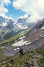
Archive image of a hiker

Example of an approach to the different areas of action of the SOLPYR project, which will work in defined pilot areas and will use the trails as an axis of action.