


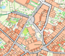
Local Topographic Reference, with detailed territorial information at an urban scale, such as buildings, vegetation, roads, and singular elements. ICGC
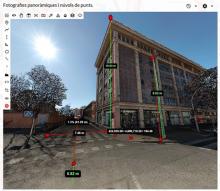
3D visualization combining panoramic photography and lidar point cloud, showing measurements on the urban scene. ICGC
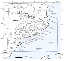
Epicentral regions defined for the location of local earthquakes. Local earthquakes are those that take place within the area delimited in blue (40.17ºN – 43.34ºN / 0.33ºW – 4.00ºE).

Epicentral regions defined by the ICGC for the location of local earthquakes. Local earthquakes are those that take place within the area delimited in blue (40.17ºN – 43.34ºN / 0.33ºW – 4.00ºE).

Total snow depth observed throughout the season in Cadí Nord (2,143 m). Source: InfoGruixNEU service.
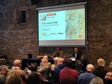
Presentation of the conference. Carles Garcia Hermosilla, director of the MUHBA, and Antonio Magariños, director of the ICGC.
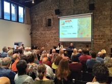
Speakers of the conference. Noelia Ramos, Cartoteca de Catalunya, and Ramon Pujades, MUHBA.