


We take our collection of local geophysical maps international with a first publication on the Vallès-Penedès basin
We are launching the dissemination of our collection of local geophysical maps of Catalonia’s main basins with the publication, in the international scientific journal Journal of Maps, of a first study dedicated to the northeastern sector of the Vallès-Penedès basin.
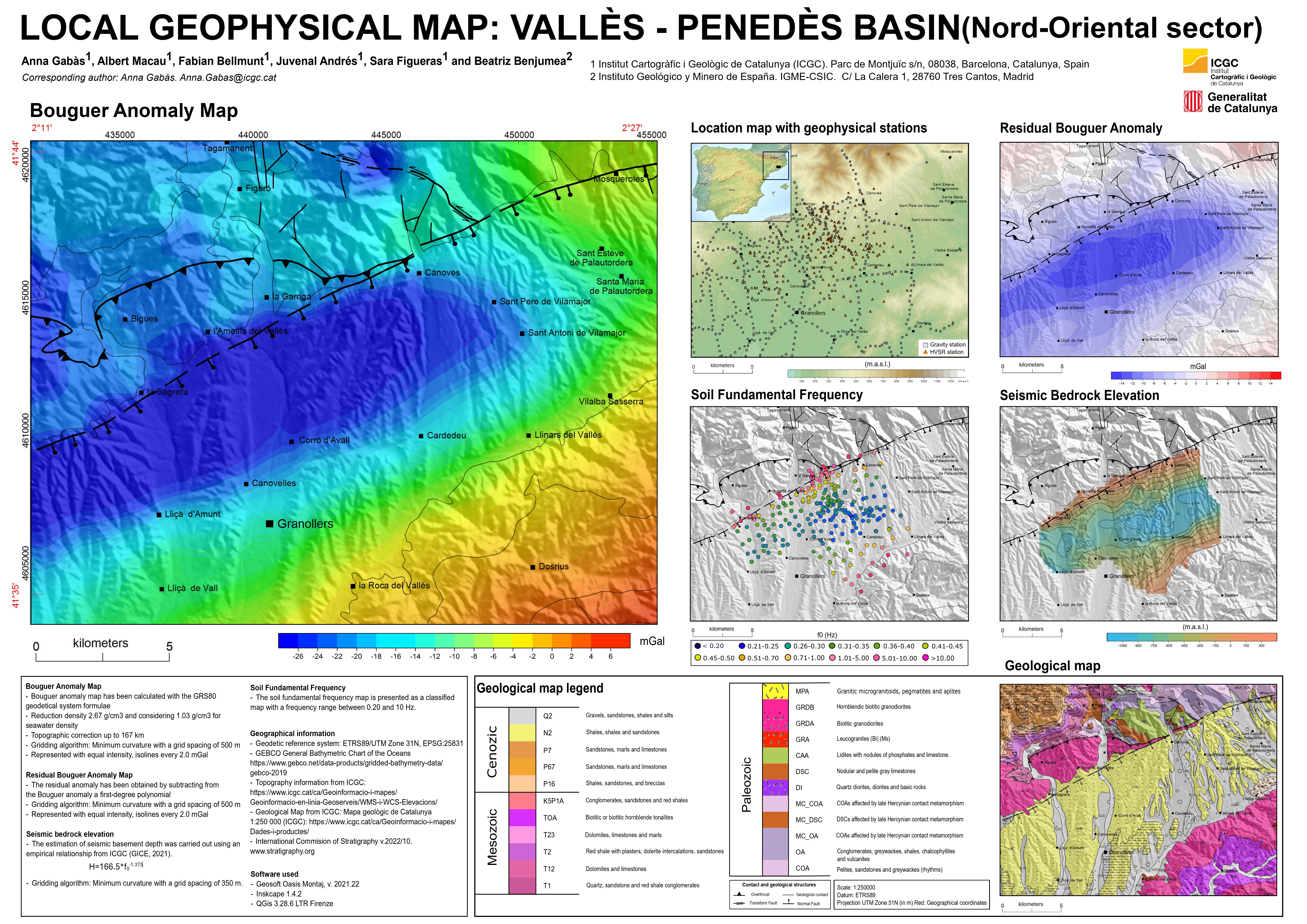
Local geophysical map: Vallès-Penedès basin (northeastern sector).
The article presents an innovative methodology for integrating and synthesizing diverse geophysical information into cartographic products that make it easier to interpret and visualize the structure of the subsurface, known as local geophysical maps. This collection integrates geophysical data acquired over the years through different techniques and campaigns, and presents it as easily interpretable cartographic information.
The study includes, among others, maps of the Bouguer gravity anomaly, the residual gravity anomaly, the fundamental frequency of the soil, and an estimate of the depth of the seismic bedrock. The study was carried out in the northeastern sector of the Vallès-Penedès basin, one of the main sedimentary basins in Catalonia, and is the first international scientific publication of our collection of local geophysical maps.
The results show a clear correspondence between gravity minima, low values of the soil’s fundamental frequency, and the deepest areas of the basin. This makes it possible to delineate the main fault-controlled depocenters and provides new evidence on the internal structure of the basin. This approach helps reduce interpretive uncertainties and provides new tools to support geological modeling of the subsurface.
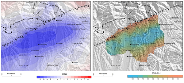
A) Residual Bouguer anomaly map of the study area, overlaid on a topographic hillshade background. B) Map of the seismic spill elevation. UTM coordinates, ETRS89, Zone 31N.
With this publication, we take a further step in developing our subsurface geophysical characterization services, giving international visibility to a line of work that has been consolidated over the years and that continues to be developed and refined in the study of Catalonia’s sedimentary basins. Integrating data from different geophysical methods into thematic maps provides a more complete picture of the structure and properties of the subsurface, fostering a better understanding of the geological environment and providing tools to support decision-making in areas such as land-use planning, infrastructure, natural resource management and geological risk assessment.