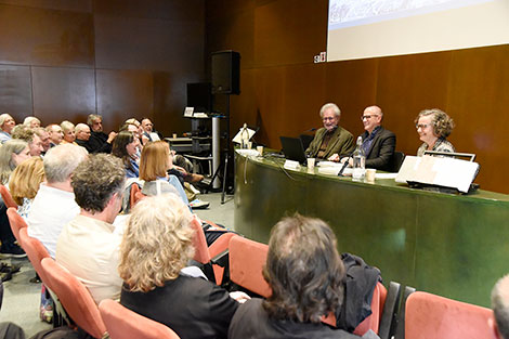
Presentation of the book Horizons and Limits for Barcelona. The Cartographic Trace
Last Wednesday, May 7th, the book Horizons and Limits for Barcelona. The Cartographic Trace was presented. This publication compiles the presentations given at the 5th Barcelona Conference on the History of Cartography. These conferences, held in November 2022 at the Historical Archive of the City of Barcelona, were jointly organized as part of a collaboration to promote knowledge and dissemination of cartographic heritage.

Presentation of the volume, Antonio Magariños, director of the ICGC (in the middle) and Ramon Grau and Carme Montaner, editors of the work (on the sides)
The book offers a diverse and rigorous look at the history of the cartographic representation of the city of Barcelona and its limits, understood not only as physical borders but also as cultural, political, and social constructs. The contributions included address how cartography has been used over time to describe, control, and project the city, often influenced by the interests of political or military power.
Through these studies, the capacity of maps to explain not only urban space but also the intentions and narratives that have shaped it is highlighted. It also champions the role of the cartographer as a mediator between the territory and society, capable of transforming data and observations into understandable and useful representations for different audiences and purposes.
The book is available in our online store.
More information can be found here.