

Topographic WMS
Topographic information to be used in your applications, through WMS geoservices

Topographic information to be used in your applications, through WMS geoservices
Orthoimages to be used in your applications, using WMS or WMTS geoservices
Mosaic of high-resolution aerial photographs of urban areas, both in color (RGB) and in color infrared (IRC)

Orthophoto of the coastal strip with a resolution generally between 10 and 15 cm above ground

Geoservei per a l’avaluació dels danys ocasionats en zones fluvials per episodis de temporals i pluges

It contains Copernicus Sentinel data from on 2015 modified by the ICGC

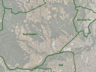
Territorial delimitation cartography to be used in your applications, using WMS and WFS geoservices
Hydrogeological map 1:25,000, Map of hydrogeological areas 1:250,000, other hydrogeological maps...
Descàrrega de la Cartografia hidrogeològica digital contínua en format Geodatabase i GeoPackage

The ICGC contributes its experience, assets and skills throughout the value chain of the new space economy (NewSpace)

L'Observació de la Terra aporta un valor afegit transversal: De la dada al coneixement

Sentinel 1 provides Synthetic Aperture Radar images that allow us to monitor surface movements with millimeter precision

Les dades d’observació de la Terra són un suport diferencial per als objectius de desenvolupament sostenible

Un enfocament cartogràfic per a proporcionar indicadors que avaluïn la sostenibilitat dels ecosistemes urbans

LIDAR data allows mapping of discrete changes at very high resolution, covering large areas uniformly and very precisely

L’existència continuada de la cartografia de cobertes que descrigui la totalitat del territori i els seus canvis permet el seguiment de la seva evolució

Complete set of images, aerial and satellite, for the creation of the Catalonia land cover map using Artificial Intelligence (AI) techniques
")
Serveis d'imatges recollides pel satèl·lit Sentinel-2 que faciliten supervisar el territori, el seu estat i els canvis produïts

To provide the capacity to avoid collapse in the face of extreme wildfires by identifying, developing and deploying innovative

To demonstrate the technological and commercial viability of an intelligent system for monitoring the territory

Collecting viewers
The Historical Territory Comparator viewer allows you to view aerial images from 1945 to the present day and compare them, either by moving them in parallel or in continuous mode.

Sentinel-2 Orthoimage Viewer from Catalonia. Contains Sentinel Copernicus data (from 2015 onwards), modified by ICGC

The ICGC selects the parameters to observe and the techniques to apply in precision farming
L'ICGC disposa de múltiples sistemes i sensors de captura de dades de la part aèria, de la superfície i del subsòl
In the 3D City models, the ICGC combines photogrammetric flight and LiDAR, with tachymetry and photography in areas of occultation
The ICGC produces light pollution maps from an airborne hyperspectral sensor and satellite images
The ICGC detects new constructions with the realization of LiDAR flights
ICGC with LiDAR data monitors the coastline and possible pollutants with airborne hyperspectral sensors and satellite images
The ICGC produces topographic, geological, geothematic cartography, orthophotos ...
The ICGC combines LiDAR data with a digital camera for the estimation of snow thickness that is integrated in the assessment of water resources
The ICGC measures subsidence with advanced techniques of differential interference DInSAR


")


