
 Contact

App that shows the territory as it is nowadays and how it was in the past


App that shows the territory as it is nowadays and how it was in the past
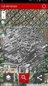
L'Ull del temps (The Eye of Time) is the mobile application developed by the ICGC that shows you how it is and how it was the place where you are and all Catalonia’s territory.
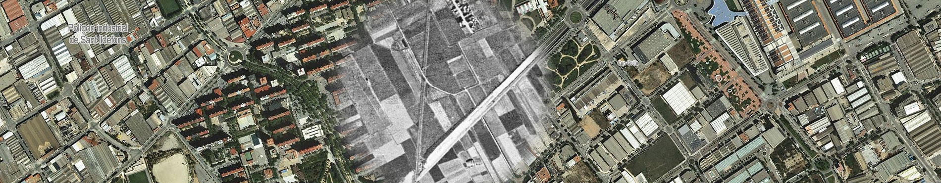
This application shows the landscape today and, when moving the cursor, it displays in a circular area how it was in 1945 or 1956 (to choose).
When enabling positioning you will see how it was the place where you are and its geographical changes. This will give you a visual experience and an in situ understanding.
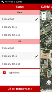
Application functionalities:
This application has, at the same time, historical, urban and leisure aspects.
This tool is based on photogrammetric flights made by the United States air force in 1945 and 1956 (copyright US Army Map Service, provided by the Defense Ministry -CECAF/CEGET- in collaboration with the Air Force) and on the current image made by the Institut Cartogràfic i Geològic de Catalunya (now reusable under CC-BY).
To send us comments or suggestions, you can use the contact form.
