
 Contact


In Catalonia, the main phenomena that have and could occur in the future are those generated by external geodynamics, such as floods, slides, falls, torrential flows, collapses and avalanches, and by internal geodynamics, such as earthquakes.
The main risk, with most impact in Catalonia, is flooding. This could affect the entire region, but mainly affects two areas: the Pyrenees and the Pyrenean foothills, and the coast and the pre-coastal area of Catalonia. During the 20th century the most important, due to their catastrophic effect, occurred in October 1907, mainly affecting the basins of the Ebre and Segre; October 1940, in the Ter and Fluvià basins; September 1962, in the regions of Vallès, Baix Llobregat and Maresme; November 1982 affecting the Pyrenean regions, and June 2000 on the mountain of Montserrat and its surrounding area.
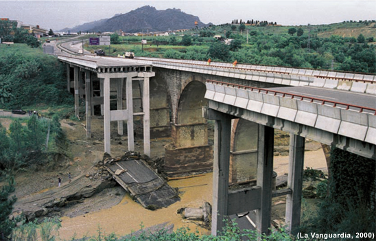
N II bridge by Esparreguera after the torrential rains of June 2000
Slides mainly occur in mountain areas with high rainfall where there is rock and soil with low resistance under certain humidity conditions. One of the most important slides recorded occurred in Puigcercós (Pallars Jussà) in 1881. A whole village had to be evacuated and its inhabitants moved to another area in the region. Slides frequently coincide with significant rainy periods, such as those in 1907 and 1982.
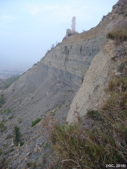
Evidence of the slide at Puigcercós
The most significant falls, and those with a large media repercussion, over the last few years occurred on the mountain of Montserrat. These can be destructive phenomena, due to both their size and high speed, and will continue to occur whilst there are cliffs and steep slopes from which fragments of unstable rock and soil can detach.
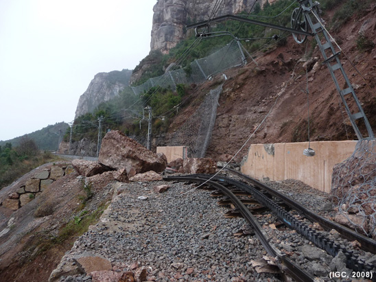
Damage to the Montserrat rack railway caused by the fall on 28 December 2008
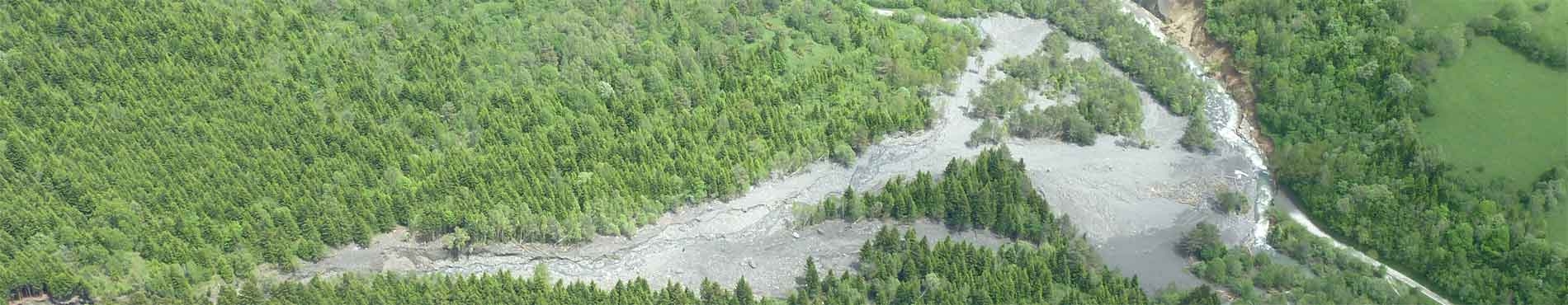
Over the last few years torrential flow dynamics related to intense rainfall have caused significant material damage. Of note are the episodes of June 2000 on Montserrat, August 2008 in the Runer river (on the Andorra-Catalonia border) and September 2008 and July 2010 at Port-Ainé.
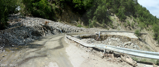
Damage to the ski resort access road in Port-Ainé after the rains of 23 July 2010
Collapses occur due to limestone, salts and carbonate formations naturally dissolving. In the case of carbonate formations, the evolution is very slow and often barely perceptible. On the other hand the evolution of salts is fast. In Catalonia there are examples of collapses in the massif of the Garraf, the Banyoles lake basin and the Vall Salina (Salt Valley) of Cardona. When we refer to collapses we talk of sinkholes, when the phenomenon is sudden and fast, or subsidence, when it is slow and progressive. Human activity can also create collapses, such as those related to mining for potassium salts. This is the case of Sallent, where the subsidence of the Estació neighbourhood is occurring, leading to the evacuation of more than 110 people in 2009.
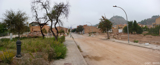
ituation of the Estació neighbourhood in Sallent, October 2010, where housing has been demolished in the area of subsidence.
4% of Catalonia is susceptible to avalanches (1,320 km2), which corresponds to 36% of the area of the Pyrenees. By region, those most affected are: Vall d’Aran, Alta Ribagorça, Pallars Sobirà, Ripollès, Cerdanya, Pallars Jussà, Alt Urgell, Berguedà and Solsonès. The first three are the areas where the risk to buildings and transport routes is highest. Historically, avalanches have caused the partial or total destruction of some villages in the Pyrenees, such as Gessa (15th century, Vall d’Aran), Senet (1632, Alta Ribagorça), Sant Joan de Toran (1855, Vall d’Aran). During the 20th century of note are the episodes in 1915, 1937, 1972 and 1996.
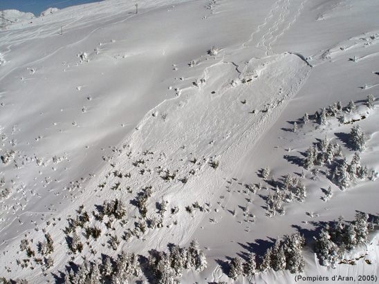
Avalanche in Pales de Ruda, 31 January 2005.
With regard to earthquakes, Catalonia has two areas of seismic activity: the Pyrenees and the Mediterranean System. The main seismic activity can be found in the Pyrenees. In the past there have been destructive earthquakes in Catalonia; 1373 in Alta Ribagorça and in 1427-1428 in the regions of Ripollès and Garrotxa. At the beginning of the 20th century, in 1923, there was an earthquake that measured 5.5 on the Richter scale, which caused damage in the Vall d’Aran. More recently, in the eastern area of the Pyrenees, in 1996, the largest earthquake recorded for the period, at 5.2 on the Richter scale, occurred in the region of Fenolledes (France). Earthquakes recorded in the Mediterranean area have been smaller than those in the Pyrenees, reaching values of over 4, in 1987 and 1995 off the coast of Tarragona; in 1991 off the Garraf coast and, in 1994, off the Maresme coast, without causing any damage.
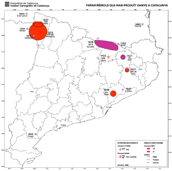
Map of earthquakes that have caused damage in Catalonia.
