Contact


Evaluation of vulnerable areas to subsidence and rise in sea level in the Ebro Delta of the Life project EBRO
The Geoíndex Life EBRO viewer facilitates the evaluation of zones vulnerable to the subsidence and the rise of the sea level. The Life EBRO ADMICLIM project proposes a set of measures aimed at determining as accurately as possible the current state of the delta, and its possible evolution as a consequence of climate change, considering the implementation of pilot actions aimed at mitigating its effects.
As a member of the consortium of this project, the ICGC has determined the historical and recent evolution of the subsidence over the Ebro Delta using satellite radar interferometry. This information has been complemented, for the elaboration of a 3D model of the structure of the sedimentary wedge that makes up the delta, by means of geophysical techniques, observations of the geological records, data of geotechnical tests and the reinterpretation and acquisition of samples of the soil and subsoil.
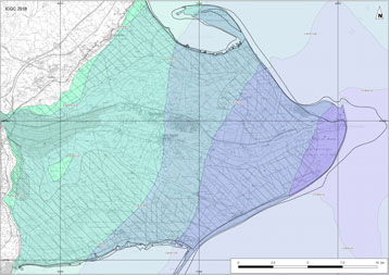
The information of surface movements and the sedimentary structure, together with the evolution of the coastline along the last century, has been integrated for the elaboration of the zoning map of the subsidence of the deltaic plain.
The Geoíndex Life EBRO viewer collects all the geological, geophysical, geotechnical, satellite and coast line data collected, the subsidence zoning resulting from the assessment of vulnerable zones to subsidence and sea level rise, and the different sedimentary units that make up the geological model of the Ebro Delta.
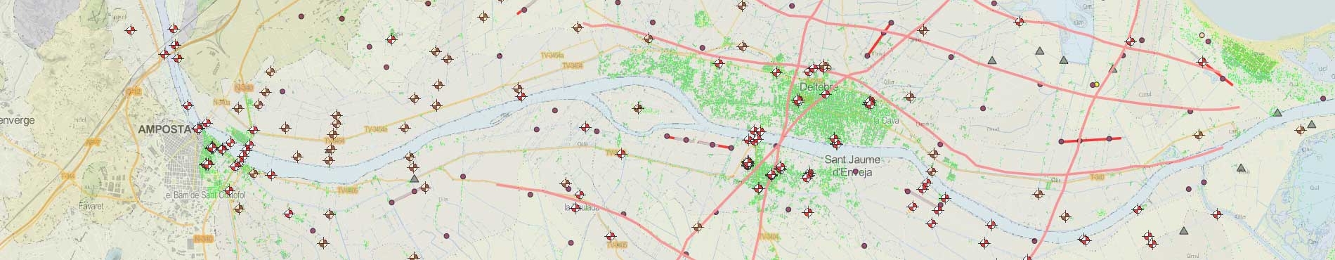
In this preliminary version of the viewer (5/18), data on terrain movements derived from the study of radar interferometry (historical and current), geophysical prospecting techniques, and boreholes and soil samples and soundings analyzed, as well as the geometry and geological characteristics of the subsoil layers of the Ebro Delta have been incorporated.