
 Contact


1:25,000 scale Catalog
Title | Edition | Year | Download | Download | e-Shop | Miniature |
|---|---|---|---|---|---|---|
Agramunt 360-2-1 (66-27) [in prep.] | 1 | 2022 | - | - | 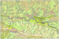 | |
Amposta 522-1-2 (63-40) | 1 | 2015 | 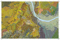 | |||
l'Arboç 447-1-1 (69-33) | 1 | 2015 | 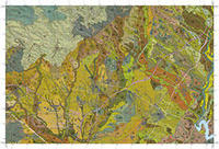 | |||
Artesa de Lleida 388-2-2 (64-30) | 1 | 2010 | 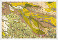 | |||
Balaguer 359-2-1 (64-27) | 1 | 2019 | 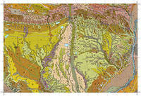 | |||
Banyuls de la Marenda 220-2-1 (78-19) Portbou 221-1-1 (79-19) | 1 | 2016 |  | |||
Belianes 389-2-2 (66-30) | 1 | 2018 |  | |||
Bellcaire d'Urgell 360-1-1 (65-27) | 1 | 2020 | 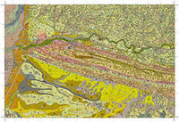 | |||
Bell-lloc d'Urgell 388-2-1 (64-29) | 1 | 2010 | 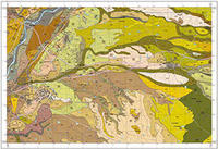 | |||
les Borges Blanques 389-1-2 (65-30) | 1 | 2011 | 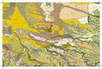 | |||
Caro 521-2-1 (62-39) | 1 | 2015 | 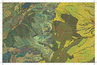 | |||
Castelldans 416-2-1 (64-31) | 1 | 2012 | 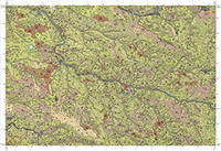 | |||
Castelldefels 448-1-1 (71-33) Vallcarca 448-1-2 (71-34) | 1 | 2014 | 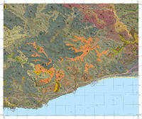 | |||
la Galera 521-2-2 (62-40) | 1 | 2017 | 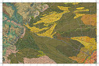 | |||
Igualada 391-1-2 (69-30) | 1 | 2018 | 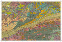 | |||
Ivars d'Urgell 360-2-2 (66-28) | 1 | 2014 | 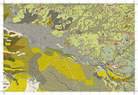 | |||
Maials 416-1-2 (63-32) [in prep.] | 1 | 2022 | - | - | 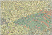 | |
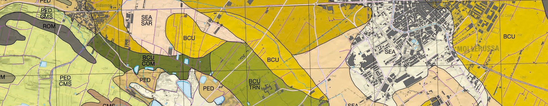
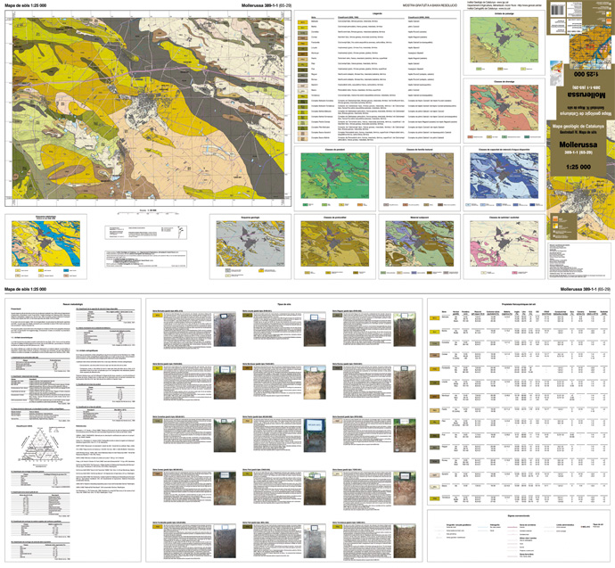
Mollerussa 389-1-1 (65-29) | 1 | 2009 | 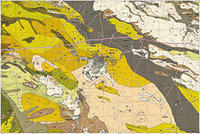 | |||
el Morell 446-1-2 (67-34) | 1 | 2018 | 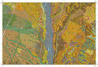 | |||
Òdena 391-1-1 (69-29) | 1 | 2019 | 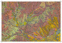 | |||
Reus 472-2-1 (66-35) Cambrils 472-2-2 (66-36) | 1 | 2017 | 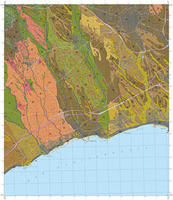 | |||
Roda de Barà 446-2-2 (68-34) | 1 | 2012 | 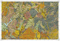 | |||
Roses 259-1-1 (79-21) Cap de Creus 259-2-1 (80-21) Far de Roses 259-1-2 (79-22) | 1 | 2016 | 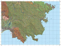 | |||
Sant Martí de Sarroca 419-1-2 (69-32) | 1 | 2015 | 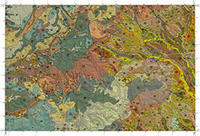 | |||
Sant Pere de Ribes 447-2-1 (70-33) | 1 | 2012 | 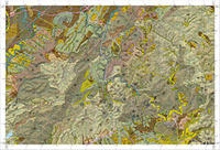 | |||
Sant Sadurní d'Anoia 419-2-1 (70-31) | 1 | 2018 | 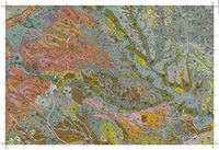 | |||
Santa Coloma de Queralt 390-2-2 (68-30) | 1 | 2020 | 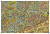 | |||
Sarroca de Lleida 416-1-1 (63-31) | 1 | 2011 | 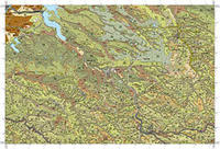 | |||
Selva del Camp 445-2-2 (66-34) | 1 | 2020 | 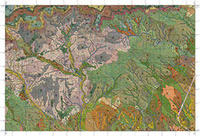 | |||
la Sènia 546-1-1 (61-41) Ulldecona 546-2-1 (62-41) [in prep.] | 1 | 2021 | - | - | 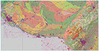 | |
Tarragona 473-1-1 (67-35) Torredembarra 473-2-1 (68-35) Salou 473-1-2 (67-36) | 1 | 2016 | 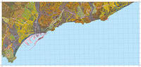 | |||
Tàrrega 389-2-1 (66-29) | 1 | 2017 | 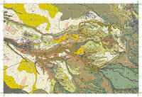 | |||
Térmens 359-2-2 (64-28) | 1 | 2010 | 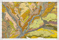 | |||
Tortosa 522-1-1 (63-39) | 1 | 2019 | 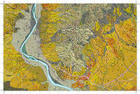 | |||
Valls 446-1-1 (67-33) | 1 | 2019 | 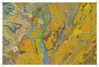 | |||
el Vendrell 447-1-2 (69-34) | 1 | 2012 | 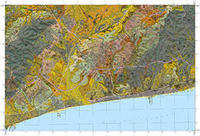 | |||
Vila-rodona 446-2-1 (68-33) | 1 | 2016 | 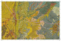 | |||
Vilafranca del Penedès 419-2-2 (70-32) | 1 | 2013 | 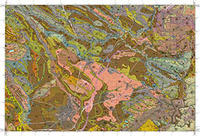 | |||
Vilanova i la Geltrú 447-2-2 (70-34) | 1 | 2013 |  | |||
Xerta 497-1-2 (63-38) | 1 | 2020 | 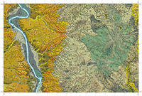 |
GT IV. Soil map 1:25,000. Project deployment
Foreword
The Geotreball IV is the instrument for carrying out the soil map at 1:25,000 scale. The soil map is a pedological content that spans the entire area of Catalonia, divided in 304 sheets defined as the formal basis 1:25,000. The availability of information on the physical and chemical soil, while they are limited and nonrenewable resources, is essential for land management in agricultural areas, land planning, civil engineering and environment in the sense broadest.
The soil map today, is done in collaboration with the Ministry of Agriculture, Livestock, Fisheries and Food, which provides detailed information around 25% of the area of Catalonia, which corresponds mainly to agricultural areas.
Field soil information is mainly obtained by performing test pits with a density of 0.25 comments per square centimeter of the final map on agricultural land and 0.125 square centimeter observations of the final map on forest land. Again, include the importance of the collaboration of municipalities, which facilitate the implementation aspects of the pits and collection of field data. The samples are subjected to various types of analysis to determine various parameters such as the organic carbon content, salinity, grain size and other parameters that define the different types of soils.
The legend of the sheets in the format of publication is divided into physiographic units, and within them, geomorphological units. Each unit contains a number of geomorphological mapping units, which represent groups of soil characteristics.
Sheet of the Soil map 1:25 000, Mollerussa 389-1-1 (65-29)
