What is it and which its potential uses are?
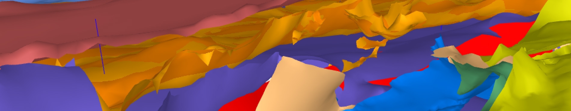
The 3D model of geological surfaces of Catalonia is the theee-dimensional representation of the main stratigraphic units and structures of Catalunya which includes deep surfaces such as the Mohorovičić discontinuity or the detachment level of the Pyrinees between the European and Iberian tectonic plates. It is a regional model on a equivalent scale of 1:250.000, which also includes the main deep drillings carried out in the 1970s and 1980s that provided data for its generation.
Its functionalities are very versatile and besides being a tool to share the knowledge of the subsurface of Catalunya, the main applications highlight are the following:
- Study and assessment of the geological resources of subsurface.
- Building of local volumetric models to the densification and improvement of the three-dimensional knowledge in special interesting areas.
- Assessment and quantification of the deep geothermal resources.
- Identification of potential targets for energy vector storage (CO2, H2 o UTES – Underground Thermal Energy Storage).
- Exploration and survey of hydric resources.
- Three-dimensional localization of earthquake focus (hypocenters).
Project evolution
The Project, started in 2009, has gradually evolved to the current version (v1.0, April 2023).
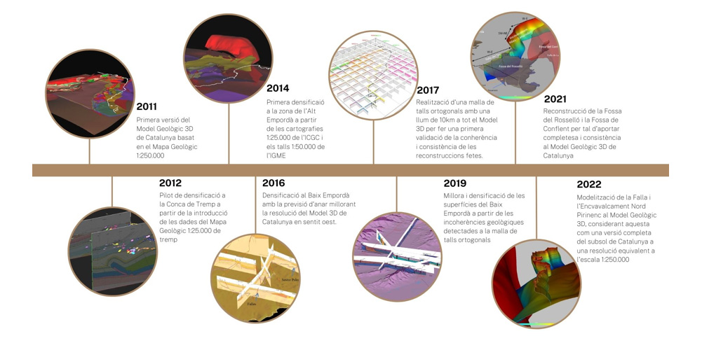
Summary graph of the evolution of the 3D geological surface model of Catalonia.
July - December 2009. During this first period, data (both subsurface and surface) are collected, especially those that are more affordable and publicly accessible. The collected data are homogenized, classified and a first quality control is carried out.
September 2010 - March 2011. This phase focuses on the adequacy and reinterpretation of both the existing geological information and the new information collected, and we work on the reconstruction to obtain a first model of 3D surfaces.
March 2011 – December 2022. Phase of densification of the model in which the geological information generated and collected by the ICGC is gradually included in the 3D model to improve its resolution. This is the case of Tremp basin, the Baix Empordà or the Rosselló graben, or the modeling of structures such as the North Pyrenean Fault or North Pyrenean thrust.
Summary outline of the different phases of work for the generation of the model.
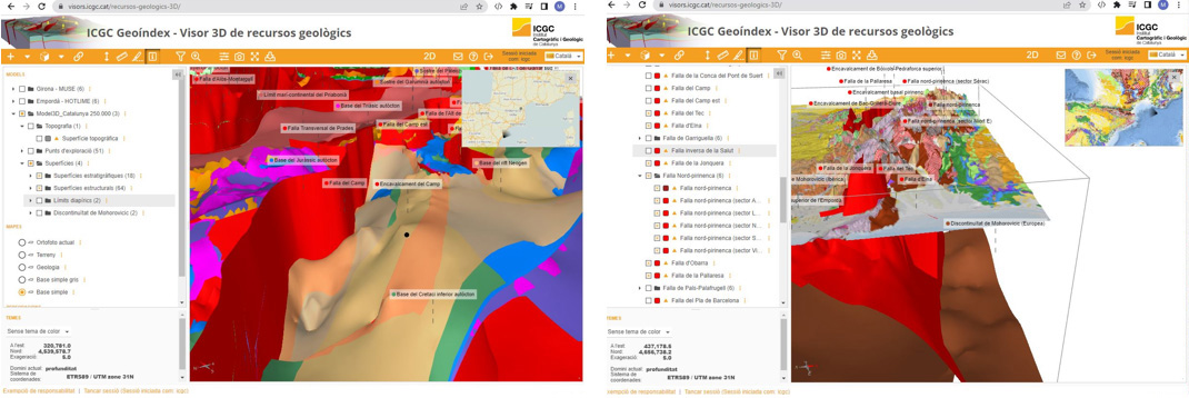
Detail of Reus-Valls basin, where densification and improvement of the main stratigraphic surfaces and structures are carried out (2022). Detail of the North Pyrenean Fault and North Pyrenean thrust area.
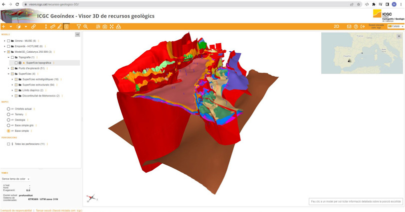
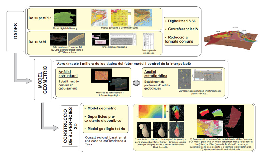
The work of modelling the geological surfaces in 3D (v1.0, April 2023), have been carried out with the collaboration of the Institut de Recerca GEOMODELS of the Barcelona University. The model has been built using the software GOCAD® by Paradigm (https://www.pdgm.com/products/GOCAD).
References
Gratacós, O., Mencos, J., Belenguer, J., Muñoz, J.A., Puig, C., Serra, L.: Avances en la difusión y tratamiento de datos geológicos: el modelo geológico 3D de Cataluña a escala 1:250.000, primeros resultados. Geotemas (Madrid), ISSN 1576-5172, Nº. 13, 2012 (Ejemplar dedicado a: VIII Congreso Geológico de España, Oviedo, 17-19 de julio, 2012.), págs. 381-384.
Gratacós, O., Serra, L., Muñoz, J.A., Berástegui, X., Mencos, J., 2015. Updating the 3D geological model of Catalunya v. 1.0: the northern sector of the Neogene Empordà Basin (NE Catalunya): 8th EUREGEO, European Congress on Regional Geoscientific Cartography and Information Systems. Barcelona June 15-17 2015.
This cartography is under the Creative Commons Attribution 4.0 International license.
More info

 Contact