Geoinformation layers by reference
These layers are linked from the QGIS project and are therefore always up to date. Internet connection is required. They include the following information:
- Cartographic slices (1:1,000, 1:2,000, 1:5,000, 1:10,000, 1:25,000, 1:50,000, 1:100,000, lidar).
- Elevation models (2 m and 5 m).
- Geological map 1:250,000.
- Land cover map (time series).
- Orthophotos: territorial orthophoto service, with the entire historical color and infrared series navigable by coverage over the years, including the provisional orthophoto of the current flight.
- Raster topographic pyramid.
- Temporary covers of frames in anaglyph stereo.
- Territorial topographic reference (time series).
- Topographic maps (1:50,000, 1:250,000).Administrative divisions (municipal capitals, municipalities, counties, vaguerías, provinces, limits of Catalonia at different scales).
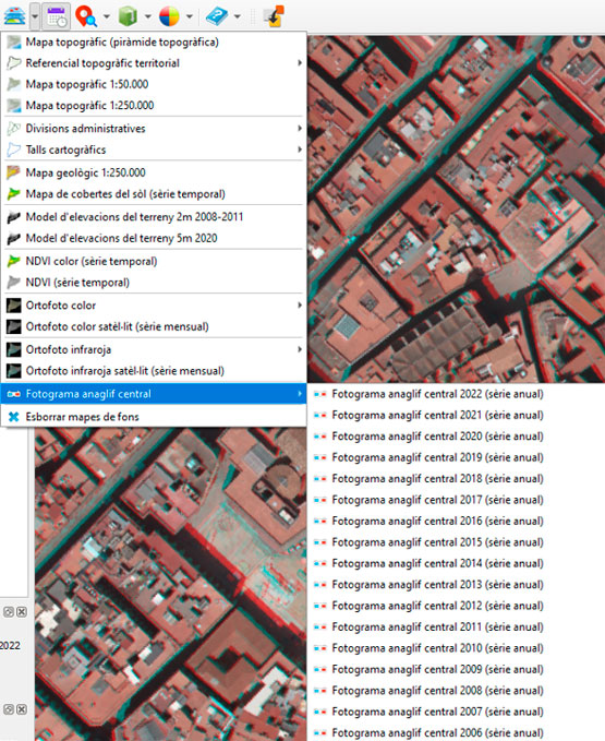
New central anàglif frame tool for visualizing the territory of temporary coverage of frames in stereo 3D and ortho on the fly
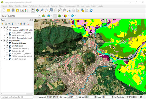
Layers for download
The layers that are downloaded can be used without an internet connection but it is the user's responsibility to update them. They include the following information:
- Topographic cartography 1:1,000 (vector).
- Administrative divisions (vector).
- Land cover map (vector and raster).
- Geological maps: 1:25,000 (GT I), 1:50,000, 1:250,000 and Map for the prevention of geological risks 1:25,000 (GT VI) (vector).
- Topographic maps: 1:25,000, 1:50,000, 1:100,000, 1:250,000, 1:500,000, 1:1,000,000, 1:2,000,000 (raster).
- Elevation models (2 m and 5 m).
- Current orthophoto and infrared (25 cm, 50 cm and 250 cm).
- Territorial topographic reference (geopackage, CAD and raster formats).
- Historical series of color and infrared orthophoto.
QGis with the Open ICGC plugin in the surroundings of Olot selected search by toponym
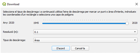
Time series download interface
Photo library catalog
It allows you to consult the frames of the ICGC photo library catalog available at one point, filter them by a range of flight dates and load them to superimpose them on the cartography of your GIS projects, with the precision that the flight instrumentation would allow at each historical moment.
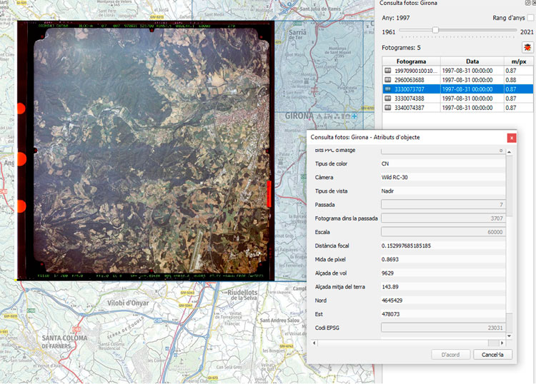
Query from QGIS of frame and dates of the flight
The photo library catalog also allows viewing options for viewing anaglyph stereo images and flight orthorectification.
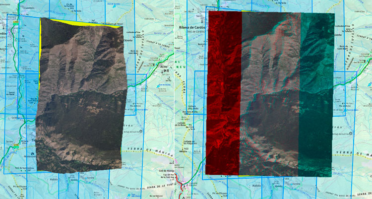
Orthorectified frame (left) and frame with stereo anaglyph view (right)
Installation
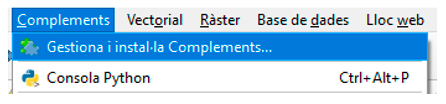
The plugin is available for download in the official QGIS store, and can be installed from the same program as any other connector, through the menu:
Complements (Plugins) > Gestiona i Instal·la Complements:
Management and installation of add-ons in QGis
The quickest way is to search for "ICGC" or "Open ICGC":
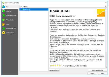
Search for Open ICGC in QGis Connectors

 Contact


