
 Contact


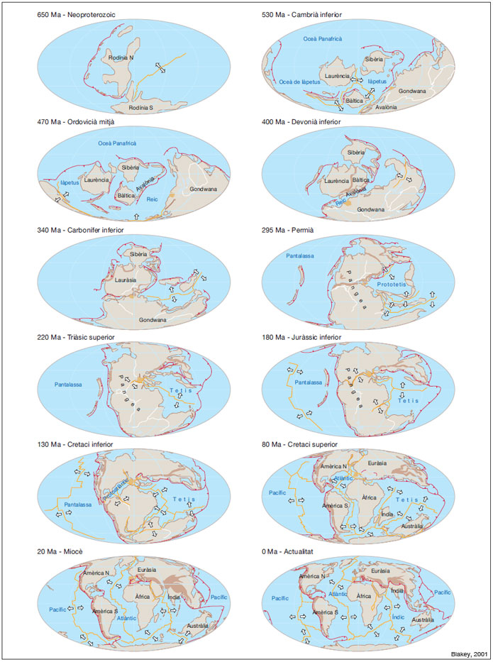
Evolution of the continents and the oceans from the Neoproterozoic until the present. In the maps, the change in the position of the continental masses and the formation and the disappearance of the oceans that separate them should be noted (originals of R. Blakey). The brown colour indicates the distribution of the orogenic belts in the emerged land; the Hercynian and the Alpine - the two most important ones represented in Catalonia - have been situated. The red lines represent the zones of subduction, and the yellow lines, with the direction of extension indicated by pairs of arrows, the position of the mid-ocean ridges; in orange the position of the current Iberian Peninsula is represented. The displacement of this from southern positions during the Proterozoic and the Paleozoic, the equatorial situation during the PaleozoicMesozoic boundary and the northern position during the entire Mesozoic and Cenozoic should be emphasized.
