
 Contact

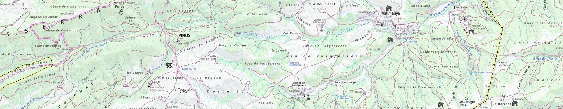


Key features
- Contour lines every 10 m
- Accuracy: 2,5 m
- Covering all Catalonia
- Format: JPG, JP2, PDF, TIF, ECW
This map can be used online in your applications compatible with the WMS protocol. More info
This cartography is under the Creative Commons Attribution 4.0 International license.![]()
More information
