Contact


From 1/12/2020, the Profile Drawing tool and the option to see the altimetric dimensions of a line (inside the Draw Line tool) will be disabled. You have these and many more features on the Instamaps platform.
Graphic profile altimetry
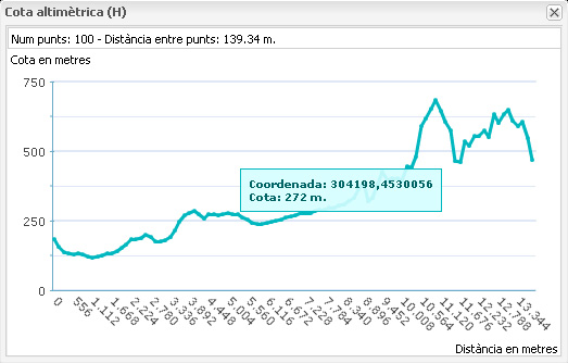
1. You can get a graphic profile of the levels of coordinates that make you when draw lines on the map. To this, simply accept the window with the corresponding question that appears on the screen to finish drawing a polyline.
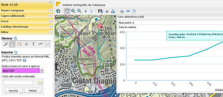
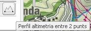
2. You can get the graphic altimetry profile between two points using the tool provided:
When you select two points, it will show a graph with a maximum of 100 points interpolated at the same distance on the line defined between the start and the end. If you want to get the highest accuracy possible, draw a line up of 1,000 meters between the start and end time will be the maximum distance of 5 meters between each point (maximum 200 points).
This may take awhile, please be patient.