
 Contact


The Soil Catalog includes the types of soil identified in Geowork IV. Soil map 1: 25,000
The Soil Catalog lists the type of soil that is the most detailed level of description used by the ICGC in its soil mapping project, at a scale of 1: 25,000 (Geotwork IV. Soil map 1: 25,000). The catalog follows to some extent the principles and recommendations set forth in the Soil Survey Manual, developed by the United States Department of Agriculture.
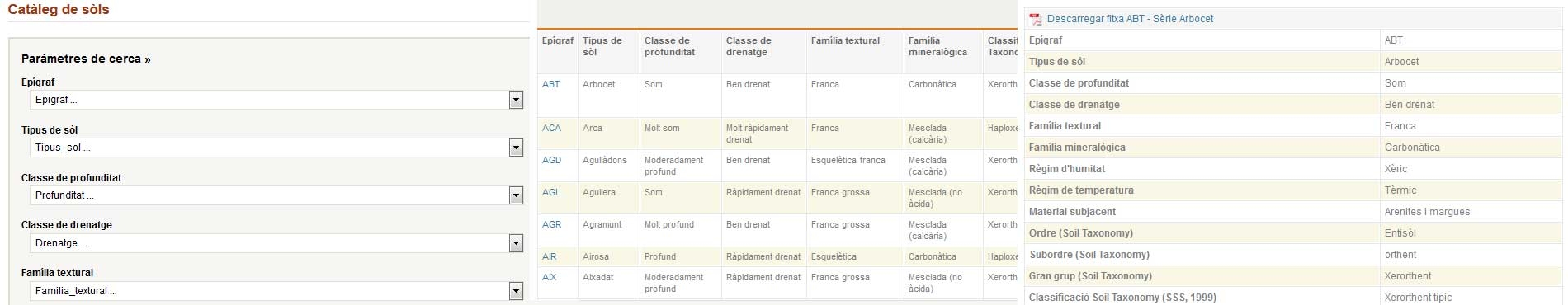
Soil types are defined, following a classification system, based on characteristics and properties that allow their unequivocal identification, as well as their easy distinction with respect to other defined soil types. In the case of the ICGC mapping program, the characteristics and properties that have been used in the creation and description of these types of soils have been1: effective soil depth, drainage class, textural class, soil content coarse elements, organic matter content, equivalent calcium carbonate content, gypsum content, soil temperature regime and soil moisture regime.
Each type of soil presents a detailed description of its morphology, the ranges of physicochemical characteristics that characterize them, the classifications according to the Soil Taxonomy (SSS2, 1999) and World Reference Base for Soil Resources (IUSS3, 2007) systems. its origin when it has been defined from soil types from previous DARP4 maps, its spatial distribution within the published sheets and a representative profile to facilitate its identification in the field.
• Last update: December 2023 • Catalog: 301 inventoried types
The names used to name these types of soils are the most common way to refer to them by technicians working in cartography. In addition, these names are usually part of the terminology used to name the cartographic units that make up land maps.
Because soil types are defined for each mapping project based on objectives and scale of work, a system is needed to easily collect, record, and update this information. In the ICGC's soil mapping program, this record is maintained through the so-called Soil Catalog. This catalog is based on the inventories of soils that, for years, has been preparing the Service of Soils and Environmental Management of Agricultural Production of the Department of Agriculture, Livestock and Fisheries (Government of Catalonia) to organize its cartographies.
In the catalog, each type of soil is defined as carefully and completely as possible based on the knowledge and relevant information that has been collected in the various cartography works carried out so far. The definition of soil types has taken into account the morphology of the soils, the physical and chemical characteristics, the geomorphological positions where they have developed and their geographical distribution. The description of each type of soil is thus summarized in a range of unique characteristics.
The soil catalog is dynamic. Maintaining and updating different soil types and their definitions is an ongoing process in the ICGC’s soil mapping program. New types of soils are being incorporated as work is carried out in areas that had not been previously mapped. In addition, when collecting new information, the definition of soil types can be slightly modified, adjusting the description ranges of the main characteristics that define them. For this reason, most soil classification systems are open and can be easily modified.
The centralized maintenance of the soil catalog ensures that strict standards are followed in its mapping program, giving consistency to the use of the different types of soils, their names and descriptions. This consistency is the main goal pursued by the correlation process in soil mapping.
The up-to-date description of the soil types in the catalog facilitates, at all times, the recognition of the observations and profiles described in the fieldwork by the technicians performing the soil mapping work. These technicians must keep in mind, at all times, the types of soils that exist in the catalog, especially those that have appeared in the adjacent areas previously mapped. They must also propose the inclusion of new types of soil that will appear as the work progresses.
