• Imprimeix

WMS NDVI

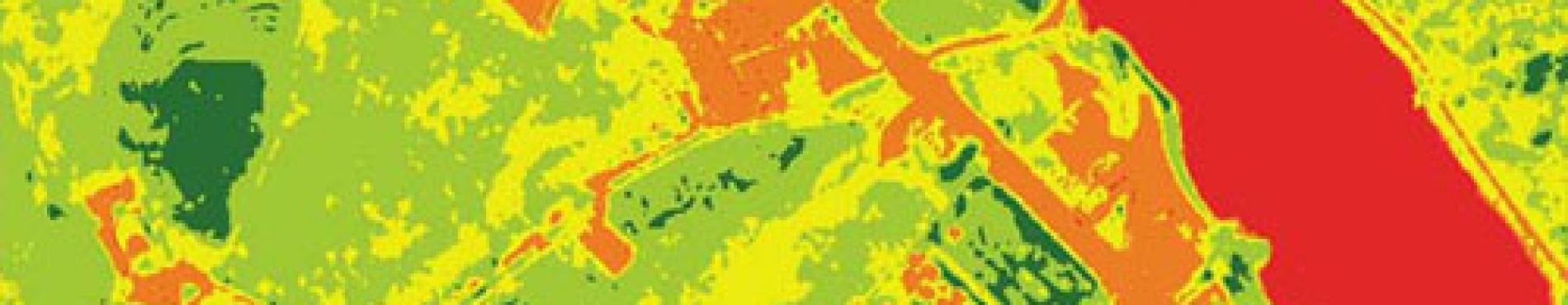
The geoservice WMS NDVI (Normalized Difference Vegetation Index) measures the growth of plants and controls the production of biomass

Connection URL

https://geoserveis.icgc.cat/icc_ndvicolor/wms/service?


Technical aspects of the service

  • Supported OGC: WMS 1.3.0.
  • Supported EPSG: 23031, 32631, 4230, 4258, 4326, 3857.
  • Supported GetMap formats: PNG, JPEG, TIFF.
  • Supported OGC methods: GetMap, GetFeatureInfo (The latter returns, among other information, the description of the state of the vegetation according to the NDVI and the classification carried out).
Download NVDI

More information and NDVI download

WMS metadata

Dates, specifications and other details

Available layers

Layer

Layer name 

Range of scales

Normalized NDVI (grayscale) [year]

ndvi_[any]

All the scales

Classified NDVI (color) [year]

ndvi_color_[any]

All the scales

Normalized NDVI (grayscale) to be used with the TIME parameter

ndvi_serie_anual

All the scales

Classified NDVI (in color) to be used with the TIME parameter

ndvi_serie_anual_color

All the scales

Example (WMS-Time layer)

Layer request with TIME enabled: the TIME parameter must be added in the WMS query indicating the year of interest (for example &TIME=2020).

https://geoserveis.icgc.cat/servei/catalunya/ndvi/wms?REQUEST=GetMap&SERVICE=WMS&VERSION=1.3.0&LAYERS=ndvi_serie_anual_color&STYLES=&FORMAT=image/jpeg&BGCOLOR=0xFFFFFF&TRANSPARENT=TRUE&CRS=EPSG:25831&BBOX=206985.645933014,4480000,573014.354066986,4780000&WIDTH=1020&HEIGHT=836&TIME=2020


Example (WMS layer)

Layers without TIME enabled are queried as standard WMS layers.

https://geoserveis.icgc.cat/servei/catalunya/ndvi/wms?REQUEST=GetMap&SERVICE=WMS&VERSION=1.3.0&LAYERS=ndvi_color_2020&STYLES=&FORMAT=image/jpeg&BGCOLOR=0xFFFFFF&TRANSPARENT=TRUE&CRS=EPSG:25831&BBOX=206985.645933014,4480000,573014.354066986,4780000&WIDTH=1020&HEIGHT=836