
 Contact

Add maps and aerial photos of the ICGC with the Application Program Interface (API) of ArcGis, Leaflet, Mapbox, OpenLayers...
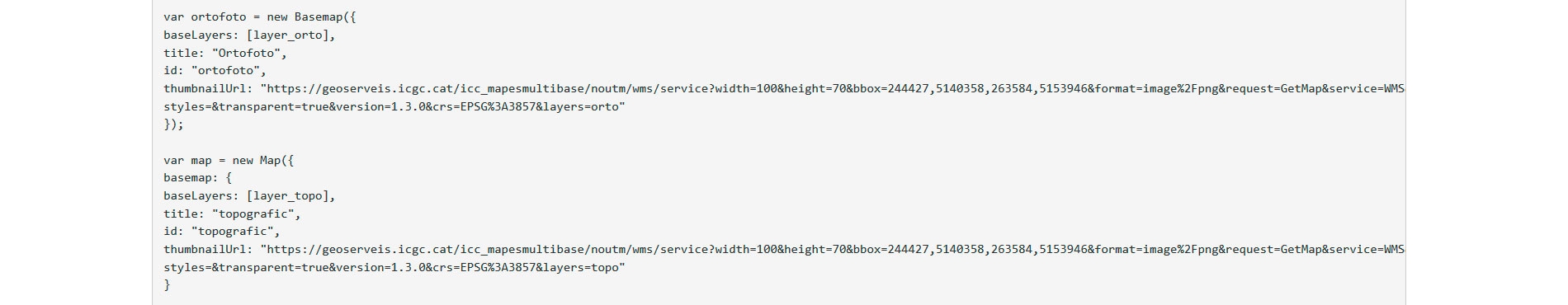


Add maps and aerial photos of the ICGC with the Application Program Interface (API) of ArcGis, Leaflet, Mapbox, OpenLayers...
