
 Contact


The maximum damages area caused by all the recorded earthquakes along the history are presented in this map.
For all preceding earthquakes to XX century an archivistic research have been performed. The descriptions of the earthquakes, sometimes in a indirect way have been interpreted, in terms of macroseismic intensity to determinate the area and the intensity.
Two well documented seismic series, have caused stronger damages in 1373 at the Ribagorça area and in 1427-1428 at la Selva, la Garrotxa, la Cerdanya and el Ripollès areas.
The estimated epicentral intensities are indicated on the map in different colours; the type of line indicates the level of the knowledgement that enable us to define the extension of the maximum damages.
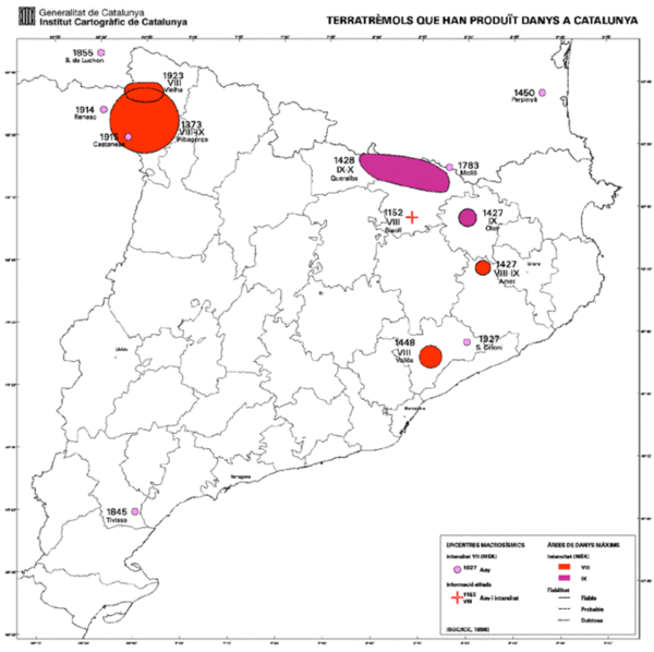
Mapa dels terratrèmols que han produït danys
