


ICGC takes part in the Esri España 2026 Conference to address the role of Earth Observation in risk management
We took part in the Esri España 2026 Conference, held on 30 September and 1 October in Madrid, with Jordi Corbera, Head of the Support Centre for the Catalan Earth Observation Programme (CS PCOT), as a speaker at the round table «Nuevas perspectivas y retos en la observación de la Tierra».
During the discussion, Corbera highlighted the role that future Earth Observation missions and services should play in risk management, and underlined the potential of artificial intelligence to move towards models capable of anticipating how situations evolve and what impact they will have on the territory.
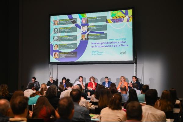
Speakers and moderators of the round table "Nuevas perspectivas y retos en la observación de la Tierra", which included representatives from the Universitat de València, the Institut d'Estudis Espacials de Catalunya, the Instituto Geográfico Nacional, the Agencia Espacial Española, TRACASA, ICEYE and the ICGC.
From observation to risk anticipation
In territorial risk management, Earth Observation can provide key information not only to understand what is happening, but also to understand how a situation may evolve and to anticipate its possible impacts.
In this regard, Corbera explained that risk management requires an integrated analysis of the exposure of the elements present in the territory and their vulnerability to natural or anthropogenic phenomena. Earth Observation data make it possible to characterise these variables, assess impacts after an event and monitor the recovery.
One of the next steps is to move towards a more predictive capability. Combining Earth Observation data and geoinformation with artificial intelligence models can make it possible to anticipate changes in land cover and analyse their possible impacts on the territory, especially in relation to the effects of climate change. This capability would strengthen the role of Earth Observation as a tool to support planning and decision-making.
AI is already applied in ICGC's processes
The shift towards predictive models also builds on the experience that the ICGC already has in applying artificial intelligence to its processes. During the round table, Jordi Corbera shared how we use machine learning techniques in various ICGC production processes, such as the automation of mapping production chains based on lidar data and the detection of changes across the territory.
These applications improve process efficiency and the quality of results, and provide a foundation for continuing to explore the possibilities of AI in the analysis and prediction of territorial phenomena.
From data to useful information
Another challenge addressed during the discussion was the need to shorten the time between acquiring an observation and turning it into useful information for users.
In this process, data quality remains a determining factor. Spatial and temporal resolution, as well as radiometric quality, determine the ability to generate reliable products suited to the needs of each application.
For this reason, at the ICGC we also emphasise co-creating solutions with end users from the early stages of projects. Involving them from the outset makes it possible to manage expectations, identify real needs and guide the development of services so that the information produced effectively supports decision-making processes.
A discussion on the future of Earth Observation
The round table «Nuevas perspectivas y retos en la observación de la Tierra» addressed the challenge of connecting the development of the Spanish space ecosystem with the needs of administrations, public bodies, companies and citizens, in a context marked by growing risks to the territory.
In addition to Jordi Corbera, representatives from the Universitat de València, the Institut d'Estudis Espacials de Catalunya, the Instituto Geográfico Nacional, the Agencia Espacial Española, TRACASA and ICEYE took part.