


Geoinformation and emerging risks: our contribution to decision-making
We took part in the conference “Critical data and risk management: deciding in contexts of high uncertainty”, where Jordi Corbera, Head of Earth Observation at the ICGC, pointed out that having more data does not mean being better prepared for emergencies: the real challenge is turning it into applied knowledge that supports decision-making. He contributed the perspective of geoinformation as a key tool to understand, prevent and manage risks in the territory.
According to the ICGC, the overabundance of data and the growing complexity of today’s risks call for mechanisms that identify which information is relevant and how it should be communicated. One of the central ideas of the talk was the need to understand risk through three factors: hazard, exposure and vulnerability. Although technology and predictive models make it possible to better estimate how some phenomena will evolve, the institute believes that real anticipation capacity lies mainly in reducing the exposure and vulnerability of people, infrastructure and ecosystems.
The role of high-quality public geoinformation as the basis for better land management was also highlighted. Concrete examples included the monitoring of aquifers using Sentinel-1 satellite imagery and the analysis of ground deformation, as well as the analysis of the state of wildfire protection strips. Studies on urban heat islands were also mentioned, which have allowed municipalities such as Olesa de Montserrat to implement climate adaptation measures, along with forest decline mapping, which has supported the planning of forest management and recovery actions.
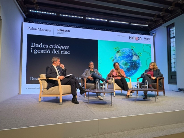
Round table at the conference “Critical data and risk management”, at the Palau Macaya in Barcelona, with the participation of the ICGC.
Looking ahead, Corbera stressed the need to strengthen specialised young talent and to make the most of artificial intelligence to move from diagnosing present situations to predicting impacts and modelling adaptation strategies. For the ICGC, the combination of reliable data, expertise and a long-term vision will be decisive in building more resilient territories.
The conference was held at the Palau Macaya in Barcelona and organised by the “la Caixa” Foundation, coordinated by the KIMbcn Foundation and in collaboration with the Institut d’Estudis Espacials de Catalunya (IEEC). Experts from different fields took part to reflect on how to turn data into useful decisions in the face of increasingly complex emergencies and phenomena.
The ICGC’s contribution took place during a round table moderated by the KIMbcn Foundation, in which Estel Blay, Program Manager at the IEEC, and Montse Sitjà, cluster manager of AeroS, also took part.