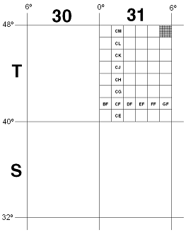
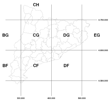
They are MGRS (Military Grid Reference System) coordinates, which can be considered a way of expressing UTM coordinates.
According to this reference system (MGRS), the land surface is divided into "rectangles" following the UTM projection: first 6º(lon)x8º(lat), then 100x100 km, then 10x10 km, etc..
The "translation", therefore, would be:
31T | 31T | precision level 6ºx8º | 31T (UTM zone) |
31TCG | 31T CG | precision level 100x100Km | 31T 300000,4600000 |
31TCG29 | 31T CG 2 9 | precision level 10x10Km | 31T 320000,4690000 |
31TCG2191 | 31T CG 21 91 | precision level 1x1Km | 31T 321000,4691000 |
31TCG213911 | 31T CG 213 911 | precision level 100x100m | 31T 321300,4691100 |
... | ... | ... | ... |

 Contact


