Contact


Calendars
2024
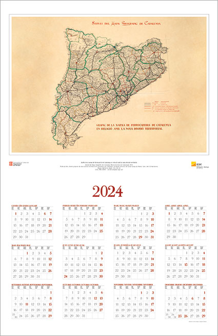
Graph of the railway network of Catalonia in relation to the new territorial division
Servei del Mapa Geogràfic de Catalunya (Mancomunitat de Catalunya), 1919.
Published in: Preliminary draft of the new territorial division of Catalonia, by the cartographer engineer, director of the Servei Josep de Rivera i Juer, plate. IX. Barcelona.
Original paper map: 103 x 83 cm (ICGC, RM.243848 – cartotecadigital.icgc.cat)
2023

Bathymetry of the Freu de les Formigues
The bathymetry has been generated by the ICGC using an airborne lidar sensor with bathymetric capabilities within the framework of the project for the map of the marine habitats of Catalonia, commissioned by the General Directorate of Environmental Policies and Natural Environment (Department of Climate Action, Food and Agenda Rural).
2022 40 anys
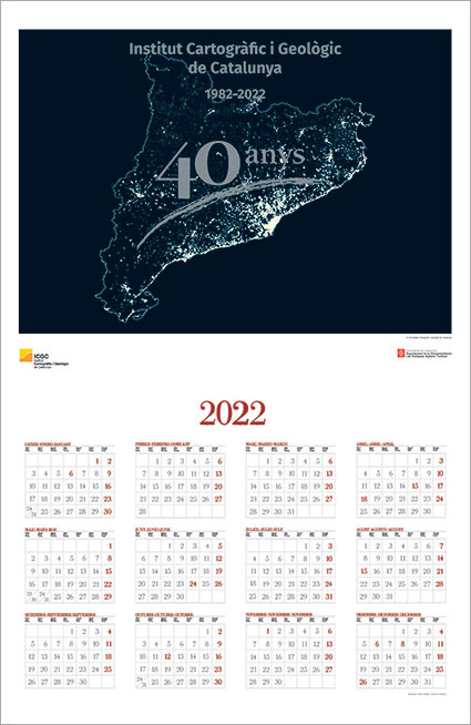
ICGC 1982-2022 40 anys
Night Catalonia map.
2022
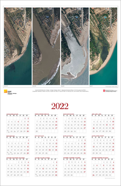
Evolution of the Delta de la Tordera: images of before, during and after the storm Gloria (January 19-23, 2020)
Photographs captured in February 2019, January 2020, May 2020 and May 2021 with an aerial photogrammetric camera.
2021
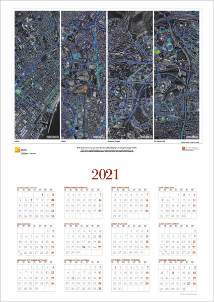
Levels of light emission for the cities of Badalona, Sabadell, Esplugues de Llobregat and Sant Cugat del Vallès
The ICGC prepares thematic cartography of light pollution, at a spatial resolution of 25 cm, based on the seu model of recovery of the flux of llum emès cap al cel in physical values of candles / m2.
2020
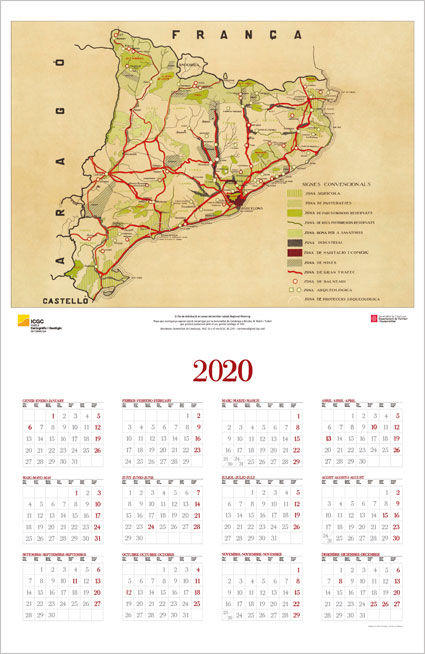
The Distribution Plan in areas of the Catalan territory: Regional Planning
Map that accompanies this study commissioned by the Generalitat de Catalunya to Nicolau M. Rubió i Tudurí which he published together with his brother Santiago in 1932.
Barcelona: Generalitat de Catalunya, 1932. 56 x 67 cm (ICGC, RL.2215 – cartotecadigital.icgc.cat)
2019
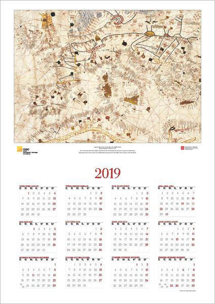
Fragment of the Nautical Charter of the Mediterranean Sea
Macià Viladesters. Mallorca, 1413.
Handwritten work made on parchment. It seems that it was entrusted by the prior of the Carthusian monastery of Valldemossa.
Département des Cartes et plans de la Bibliothèque nationale de France (BNF, Cartes et Plans, GE AA-566 (RES)
2018
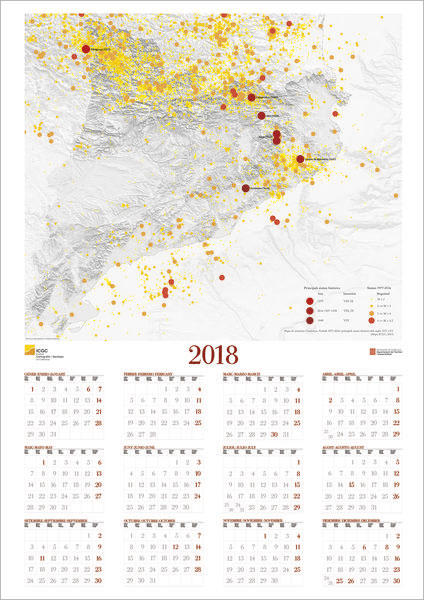
Seismicity map of Catalonia
Period 1977-2016 and main historical earthquakes of the 14th and 15th centuries.
(Mapa ICGC, 2017)
2017
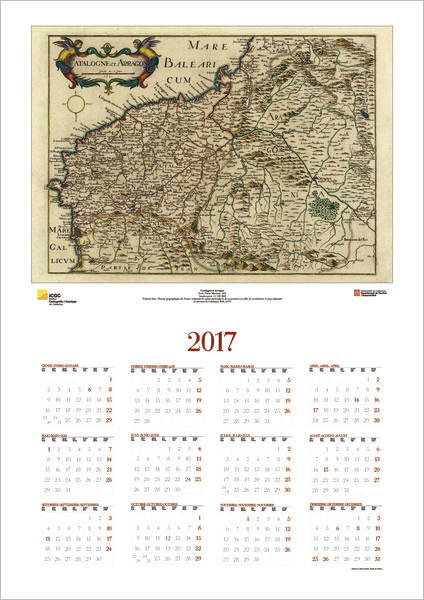
Catalogne et Arragon
París: Pierre Mariette, 1641
[escala aprox. 1:1 200 000] Publicat dins: Theatre geographique de France contenant les cartes particulieres de ses province et celles de ses fronteres & pays adjacents
(Cartoteca de Catalunya, RM, 4572)
2016
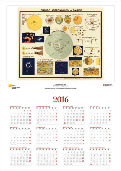
Astronomical painting, by Paluzie
Imprenta Elzeviriana y Librería Camí, [ca. 1930]
52 x 66 cm, in sheet of 68 x 83 cm
(Cartoteca de catalunya, Fons Paluzie, RM.293191)
2015
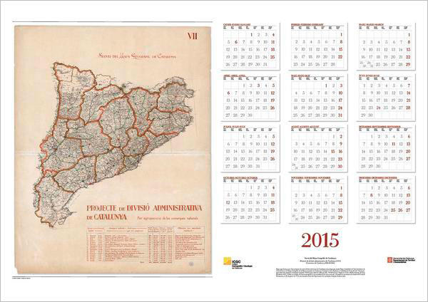
Geographic Map Service of Catalonia
Project of administrative division of Catalonia (1919)
(Cartoteca de Catalunya, RM.243846)
2014
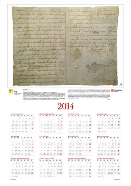
Philip V of Spain
(Versalles 1683-Madrid 1746)
Autograph letter signed and addressed to his grandfather Louis XIV of France, dated December 28, 1711
2013
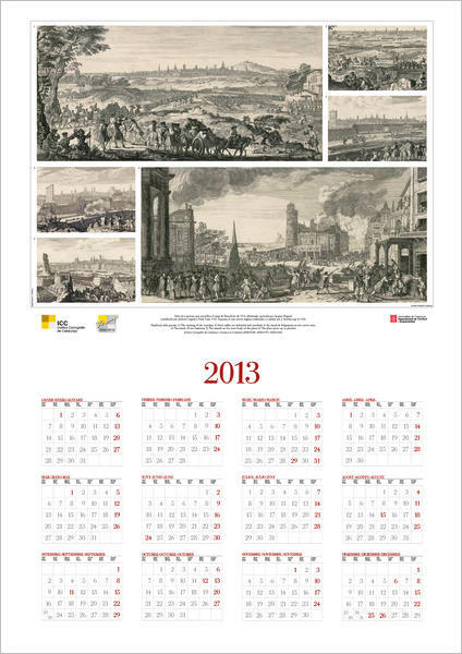
Series of 6 engravings depicting the siege of Barcelona in 1714, drawn and engraved by Jacques Rigaud and first published in Paris in 1732. This is an English edition made in London by J. Bowles around 1750
Institut Cartogràfic de Catalunya, Cartoteca (RM215789 a RM215793 i RM215343)
2012
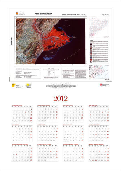
30 years of the Cartographic Institute of Catalonia
Reproduction of an eye of the first series of satellite image 1: 100,000 in false color elaborated by the ICC between the years 1985-1987 and originated from the combination of channels 5, 4, 1 of the satellite Landsat-5.
The series consists of 27 serial cutting sheets and 5 special cutting sheets.
The Ebro Delta is a special cut leaf. (85 x 60 cm)
Cartoteca de Catalunya (CTCRMM13761)
2011
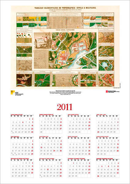
French manual of topographic drawing of the 19th century
Tableau elémentaire de topographie civile & militaire, a l'usage des ingénieurs géographes & de toutes les écoles.
Par G. Tripon F. Professeur de dessin & auteur de plusieurs ouvrages elémentaires. Paris, 1800 (54 x 68 cm)
Cartoteca de Catalunya (RESM-A-22-32)
2010
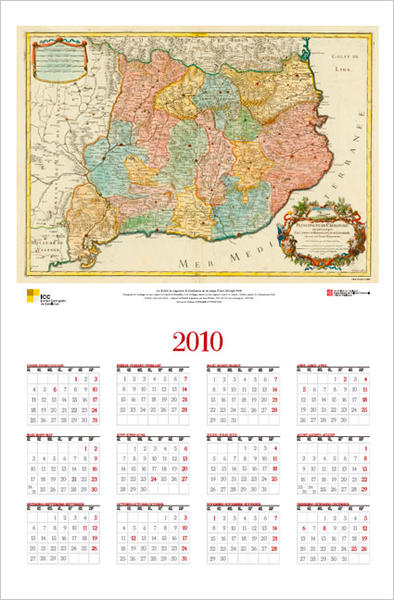
The division into veguerias of Catalonia in a map of the beginning of the XVIII century
Principaute de Catalogne ou sont compris les Comtés de Roussillon, et de Cerdagne, divisés en leurs vigueries / par le Sr. Sanson ; Caordier sculpit ; S. f. [Simonneau fecit].
A Paris : chez le Sr. Laillot... joignant les Grands Augustins, aux deux Globes, 1706 ( 44 x 63 cm; escala aprox. 1:650.000)
Cartoteca de Catalunya, RES-A-6-24 (CTCRM0215361)
Pòsters
Mapa de les terres de llengua catalana
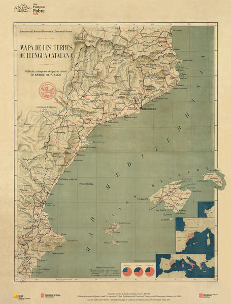
Mapa de les terres de llengua catalana, escala 1:500.000
Publicat in spite of the Catalan patron Dr. Antoni de P. Aleu. Publications of the Protective Association of Catalan Education. Any 1921.
Facsimile published by l'Institut Cartogràfic i Geològic de Catalunya in commemoration of l'Any Pompeu Fabra 2018.