Catalunya Offline is an application for mobile phone developed by the Institut Cartogràfic i Geològic de Catalunya (ICGC), which allows you to move around Catalonia, to take points and record your routes and trips with the GPS even when you don’t have data coverage on your mobile phone.
This application allows the downloading and visualization of the ICGC cartography, both the topographic map and the orthophotomap:
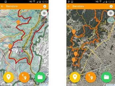
- The topographic map shows its information structured and in a hierarchical way to facilitate the reading of the map. Contour lines and information regarding the mountain trails are shown.
- The orthophotomap shows the detail of the terrain at large scales. This image is complemented with certain geographic information in order to facilitate its comprehension: roads, paths, trails and place names.
The level of detail of the cartography seeks the commitment between its good usability and the volume of data of the files that are downloaded. If you have an SD card, the files will be stored there so as not to occupy the internal memory of your device.
Downloading of cartography to be off-line used can be done in two ways:
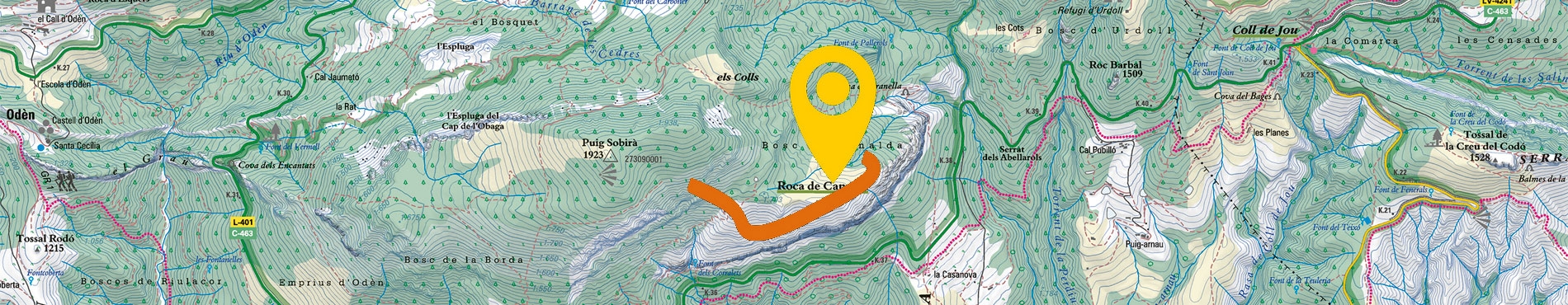
- All Catalonia in a single file, by means of vector tiles technology on the 1:25,000 map. In this case, a 3D simulation of the buildings that helps to understand the territory, especially in urban areas, can be visualized.
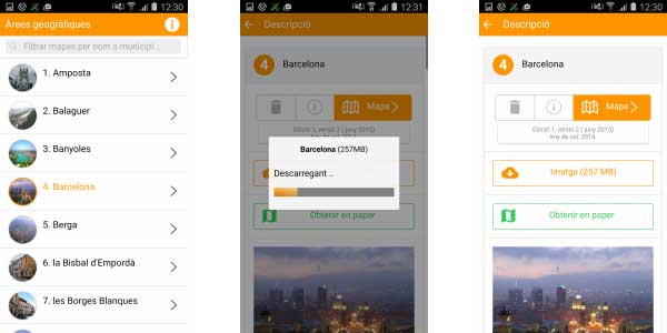
- From the 77 geographical units in which the paper version of the topographic map of Catalonia at a scale of 1: 25,000 is published.
You can also use your own cartography in MBTiles format or you can create your own MBTiles files, from georeferenced maps, with the free QGIS open source software. In addition, the ICGC offers you the following cartography in MBTiles format: Topographic map of Catalonia 1: 250,000, Road map of Catalonia 1: 250,000 and Topographic map of Catalonia 1: 50,000.
Application functionalities:
- Downloading of topographic map and orthophotomap to be consumed offline (we recommend downloading the files in wireless networks due to the size of the files).
- Use of your own cartography in MBTiles format.
- Location on the map of user’s position.
- It allows you to see coordinates of points, in geographic and in UTM (ETRS89) format.
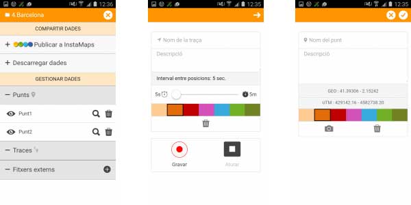
- Creation of points on the map, from the mobile phone positioning or by clicking on the map where we want to place the point. We can assign a name and a description to the point, associate pictures to it and choose its colour.
- Recording of routes and tracks. We can assign a name and a description to the route, choose its colour and establish the interval of collection of positions. We can also pause the recording.
- The application allows you to upload routes and points that are contained in files (external files). Formats: GPX and KML.
- The files you create can also be downloaded. Formats: GPX and KML.
- Turning on and turning off the layers concerning rural tourism, campsites, hostels and mountain refuges.
- The set of points and routes can be marked as visible or not, and can also be deleted.
- The application allows you to publish the data collected as a map to Instamaps. Instamaps is a free web tool from the ICGC that allows you to view, work on and put online your geographic information and routes in two and three dimensions. You must have an Instamaps account. Points and routes that are published in Instamaps are the ones visible when published.
- You can also customize the size of the buttons and the colour of the positioning icon.
- Search for place names (towns, places, villages) to determine the map or maps inside the area of interest. You can also use the map number.
- View the graphical scale.
To send us comments or suggestions, you can use the contact form.

 Contact