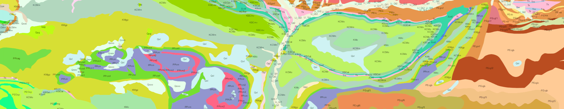
Mapa geològic comarcal 1:50.000
URL de connexió
https://geoserveis.icgc.cat/servei/catalunya/icgc_mg50m/wms?
Característiques tècniques del servei
- OGC suportat: WMS 1.0.0, 1.1.0, 1.1.1, 1.3.0.
- EPSG original: 25831.
- EPSG suportats: 23031, 32631, 4230, 4258, 4326, 3857.
- Formats GetMap suportats: GIF, PNG, BMP, JPEG, TIFF, SVG+XML.
- Mètodes OGC suportats: GetCapabilities, GetMap.
Capes disponibles
Capa | Nom capa | Rang d'escala |
|---|
Contactes i elements geomorfològics | CNEG_LN | 1:40.000 | 1:200.000 |
Dipòsits antròpics | DANT_PA | 1:40.000 | 1:200.000 |
Falles i plecs | FAPL_LN | 1:40.000 | 1:200.000 |
Unitats geològiques | UGEO_PA | 1:40.000 | 1:200.000 |
Exemple de petició de servei
https://geoserveis.icgc.cat/servei/catalunya/icgc_mg50m/wms?REQUEST=GetMap&SERVICE=WMS&VERSION=1.3.0&LAYERS=UGEO_PA&STYLES=&FORMAT=image/png&BGCOLOR=0xFFFFFF&TRANSPARENT=TRUE&CRS=EPSG:25831&BBOX=351071,4589853,378672,4618096&WIDTH=817&HEIGHT=836
▲ Tornar amunt
Mapa geològic 1:250.000
URL de connexió
https://geoserveis.icgc.cat/arcgis/services/geologic/icgc_mg250m/MapServer/WMSServer?
Característiques tècniques del servei
- OGC suportat: WMS 1.0.0, 1.1.0, 1.1.1, 1.3.0.
- EPSG original: 25831.
- EPSG suportats: 23031, 32631, 4230, 4258, 4326, 3857.
- Formats GetMap suportats: GIF, PNG, BMP, JPEG, TIFF, SVG+XML.
- Mètodes OGC suportats: GetCapabilities, GetMap.
Capes disponibles
Capa | Nom capa | Rang d'escala |
|---|
Contactes | CONT_LN | 1:200.000 | 1:1.000.000 |
Dipòsits antròpics | DANT_PA | 1:200.000 | 1:7.000.000 |
Falles | FALL_LN | 1:200.000 | 1:1.000.000 |
Unitats geològiques | UGEO_PA | 1:200.000 | 1:7.000.000 |
Exemple de petició de servei
https://geoserveis.icgc.cat/arcgis/services/geologic/icgc_mg250m/MapServer/WMSServer?REQUEST=GetMap&SERVICE=WMS&VERSION=1.3.0&LAYERS=UGEO_PA&STYLES=&FORMAT=image/png&BGCOLOR=0xFFFFFF&TRANSPARENT=TRUE&CRS=EPSG:25831&BBOX=337974,4580461,384105,4627665&WIDTH=817&HEIGHT=836
▲ Tornar amunt
Mapa geològic 1:50.000 ràster
URL de connexió
https://geoserveis.icgc.cat/arcgis/services/Geologia/MGC50mv1r01(raster)/ImageServer/WMSServer?
Característiques tècniques del servei
- OGC suportat: WMS 1.0.0, 1.1.0, 1.1.1, 1.3.0.
- EPSG original: 25831.
- EPSG suportats: 23031, 32631, 4230, 4258, 4326, 3857.
- Formats GetMap suportats: GIF, PNG, BMP, JPEG, TIFF, SVG+XML.
- Mètodes OGC suportats: GetCapabilities, GetMap.
Capes disponibles
Capa | Nom capa | Rang d'escala |
|---|
MGC50mv1r01o.tif | 0 | Totes les escales |
Exemple de petició
https://geoserveis.icgc.cat/arcgis/services/Geologia/MGC50mv1r01%28raster%29/ImageServer/WMSServer?REQUEST=GetMap&SERVICE=WMS&VERSION=1.3.0&LAYERS=0&STYLES=default&FORMAT=image/png32&BGCOLOR=0xFFFFFF&TRANSPARENT=FALSE&CRS=EPSG:25831&BBOX=314571,4562173,391672,4641067&WIDTH=817&HEIGHT=836
▲ Tornar amunt
Mapa geològic 1:250.000 ràster
URL de connexió
https://geoserveis.icgc.cat/arcgis/services/Geologia/mgc250mv2(raster)/ImageServer/WMSServer?
Característiques tècniques del servei
- OGC suportat: WMS 1.0.0, 1.1.0, 1.1.1, 1.3.0.
- EPSG original: 25831.
- EPSG suportats: 23031, 32631, 4230, 4258, 4326, 3857.
- Formats GetMap suportats: GIF, PNG, BMP, JPEG, TIFF, SVG+XML.
- Mètodes OGC suportats: GetCapabilities, GetMap.
Capes disponibles
Capa | Nom capa | Rang d'escala |
|---|
MGC250mv20f00r01.tif | 0 | Totes les escales |
Exemple de petició
https://geoserveis.icgc.cat/arcgis/services/Geologia/mgc250mv2(raster)/ImageServer/WMSServer?REQUEST=GetMap&SERVICE=WMS&VERSION=1.3.0&LAYERS=0&STYLES=&FORMAT=image/png&BGCOLOR=0xFFFFFF&TRANSPARENT=FALSE&CRS=EPSG:25831&BBOX=304152,4589326,391219,4678418&WIDTH=817&HEIGHT=836
▲ Tornar amunt
Mapa estructural de Catalunya 1:250.000
URL de connexió
https://geoserveis.icgc.cat/arcgis/services/geotermia/estructural/MapServer/WMSServer?
Característiques tècniques del servei
- OGC suportat: WMS 1.0.0, 1.1.0, 1.1.1, 1.3.0.
- EPSG original: 25831.
- EPSG suportats: 23031, 32631, 4230, 4258, 4326, 3857.
- Formats GetMap suportats: GIF, PNG, BMP, JPEG, TIFF, SVG+XML.
- Mètodes OGC suportats: GetCapabilities, GetMap.
Capes disponibles
Capa | Nom capa | Rang d'escala |
|---|
0 | Estructural_250M | - | 1:100.000 |
Exemple de petició:
https://geoserveis.icgc.cat/arcgis/services/geotermia/estructural/MapServer/WMSServer?REQUEST=GetMap&SERVICE=WMS&VERSION=1.3.0&LAYERS=0&STYLES=&FORMAT=image/png&BGCOLOR=0xFFFFFF&TRANSPARENT=FALSE&CRS=EPSG:25831&BBOX=304152,4589326,391219,4678418&WIDTH=817&HEIGHT=836
▲ Tornar amunt


 Contacte

